
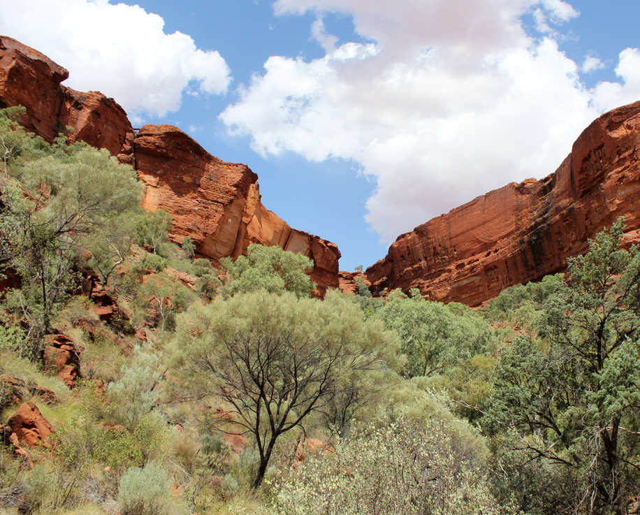
Enjoying the red cliffs of Kings Canyon
Looking up to the rim—at the end of the Kings Creek walk
At long last, I made it to Kings Canyon in Australia’s Red Centre. I’ve been to the heart of this great continent three times—seen Uluru, Kata Tjuta and Alice Springs—but this was my first visit to the canyon.
It’s so impressive. The red sandstone cliffs surrounding the canyon rise 100 metres above the canyon floor and the scenic Kings Creek snakes through the base.

Fancy going up those steps on a hot day?
The canyon is part of Watarrka National Park. It’s an important conservation area that features 600 species of native plants (10 per cent of those are considered rare) and permanent waterholes. There are also some great Aboriginal artworks, but their locations are off the beaten track and not promoted to ensure they aren’t vandalised.
We’d hoped to do the canyon’s magnificent Rim Walk, but it was closed because of high temperatures (it hit 46°C while we were there). Opening times for this walk are shortened when temps hit 36° (no walking after 9am), and closed completely when temps exceed 42°. It’s a sensible approach. There is absolutely no shade up on the rim, plus there’s a killer set of steps at the beginning of the walk.
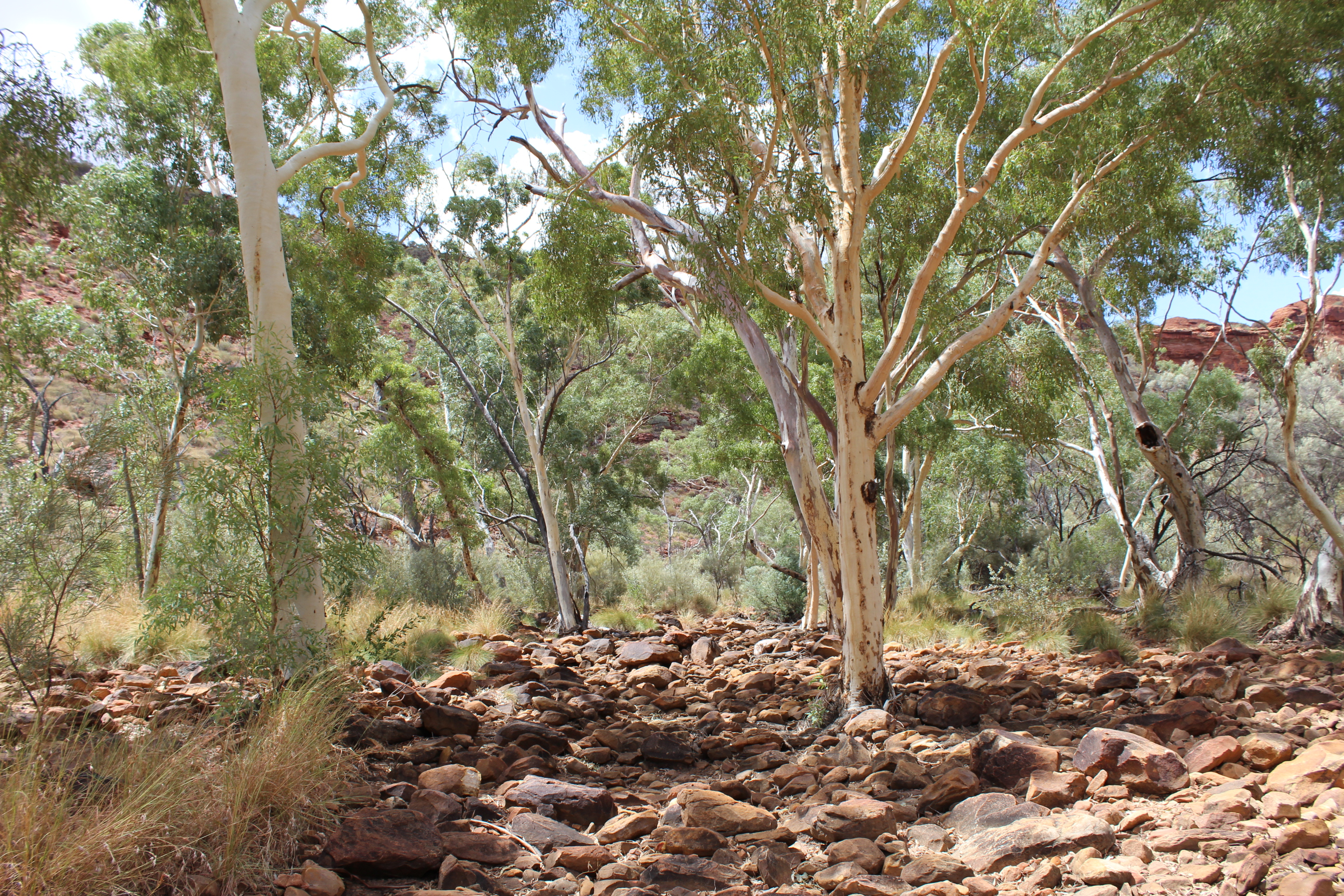
A very dry Kings Creek
So we did the Kings Creek walk instead. It took about an hour and was very dry (no sign of the actual creek). There’s a platform at the end of the path where you get a great view of the rim.
For thousands of years the creek and canyon have had enormous spiritual meaning for the Luritja people. Scientists estimate that the Luritja have lived in the area for 20,000 years.
But white people didn’t discover these places until 1872 when explorer Ernest Giles and his party arrived. I was interested to learn that he named both sites after his friend, Fielder King, and not after some king of the time.
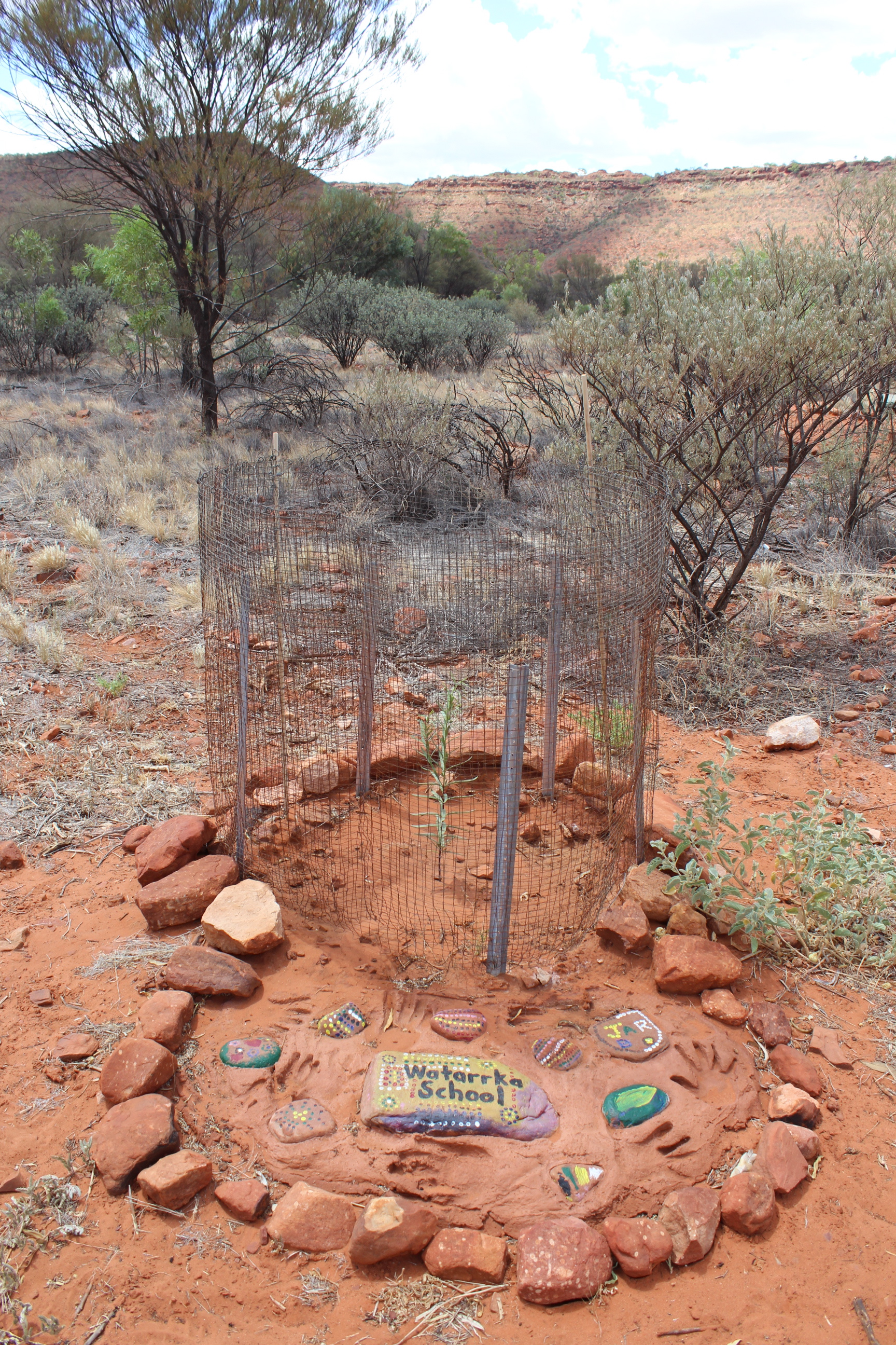
Tree planted by students from Watarrka School
By the late 1880s, cattlemen were settling in the area with Tempe Downs being the main station. Kings Canyon and surrounds are definitely not cattle country and, after a run of bad seasons, the station didn’t have enough grass or water to maintain a herd.
Jack Cotterill visited the canyon in 1960 and were so overwhelmed by its beauty that the Cotterill family started the push for tourism. In the summer of 1960-61, they built a road to the canyon, and a tourist lodge. Just over 20 years later, Tempe Downs surrendered 1059 square kilometres of land so a national park could be established. Watarrka National Park was formally declared in 1989.
We stopped for lunch at the small picnic ground near the canyon entrance. That’s where we saw a small tree planted by children from Watarrka School.
I’m looking forward to a repeat visit so we can actually do the Rim Walk and see some water in the creek. Maybe I can arrange to ride in on a camel.

What a shame you did not get to do the Rim Walk, but only creates another reason for you and Poor John to yearn to return 🙂 LOVE your photos always but am really enjoying the slideshows too! WHOO HOO!
Cheers! Joanne
LikeLike
Thanks Joanne. We were disappointed to miss the Rim Walk, but it was just too darn hot. Glad you like the slideshows. I think it’s a good way to give more of an overview.
LikeLike
Yet another place to visit when I get back to Oz.
Yup I do know it can get a ‘shade warm’ around these places and a bottle or two of water is definitely wanted, I’d liked to see it from the rim. Is the sunset any better than Uluru ? (I was a bit disappointed with that)
Great set of photos, liked the slideshow 🙂
Do they do these ‘Champagne sunset’ things here as well ?
The kids tree looked like it could do with a good long drink.
LikeLike
Hi Derrick. Glad you like the photos and slideshow. Kings Canyon is still pretty low-key tourist-wise, so no champagne sunsets. That’s probably because the canyon walls are so high you can hardly see the sun go down.
But I know what you mean about Uluru sunsets. I’ve seen three. One was sensational and the other two weren’t nearly as impressive.
It rains at least some in Kings Canyon. I’ve seen photos of waterfalls off the rim. The ‘rainy’ season is there now, so I hope that tree is getting that much-needed drink. 🙂 Apparently April is the ideal month to visit.
LikeLike
Those photos are great Peggy. The colours are so rich! But I’m sure you didn’t mean to describe that rockface as ‘steps’. That part looked as if there had been a rockslide. Too much for my delicate sensibilities. But more power to you and John for doing it. Well done!
LikeLike
Oh Louise, those really are the steps up to the Rim Walk. And I agree, they look more like a landslide. I reckon I’d walk up and come down on my bum, but not when it’s 46°C.
LikeLike
I wouldnt mind a bit of 46 C at the moment 🙂
LikeLike
You might have to go to Turkmenistan to get that.
LikeLike
Your photos illustrate beautifully our national anthem,
‘I love a sunburnt country,
A land of sweeping plains,
Of ragged mountain ranges,
Of droughts and flooding rains.’…….
LikeLike
Oh Mary, thanks so much for seeing the connection with ‘A sunburnt country’.
LikeLike