

A long view of the Taj
India’s Taj Mahal, with its glistening white marble exterior, is probably one of the world’s best-known and most-loved sights.
It’s so dazzling, so beautiful and so elegant that it’s sometimes a stretch to remember that it’s a mausoleum and a tomb.
Mughal emperor, Shah Jahan, had the Taj Mahal started in 1632 to honour the memory of his beloved third wife, Mumtaz Mahal, who died the previous year while giving birth to her 14th child.
The main structure took 17 years to complete and is considered the greatest achievement across the whole range of Indo-Islamic architecture.


It’s a wonderful mix of solids and voids, arches and domes, and intense colours. White marble against a deep blue sky, flashes of precious and semi-precious stones, hues of lush plants in the surrounding gardens, even the reddish gravel on the paths work together to showcase the Taj’s ever-changing moods.
I think it’s fitting to record the names of some of the people who helped to create this fabulous complex. Ustad Ahmad Lahori was the main architect. Ustad Isi Afandi prepared the site plan. The stylish calligraphy is attributed to Amanat Ali Khan Sharazi, while Ran Maj from Kashmir designed the gardens.

Surrounded by colour
Thousands of masons, stone-cutters, inlayers, carvers, mosaicists, painters, calligraphers, dome builders and other artisans came from all over the empire, as well as Central Asia and Iran. After finishing the white marble centrepiece, the workers stayed on for another five years to build a mosque, a guest house, the main gateway on the south, and the outer courtyard and its cloisters.
The Taj sits on 17 hectares of gardens that are divided into four parts. Unusually, the tomb was placed at the back of the landscape rather than in the centre, which is why visitors approach it across a wonderful and long vista.

It’s that long view that really emphasises the Taj Mahal’s beauty and form. Instantly you can see its four matching minarets, its symmetrical design, its many arches, its brilliant white colouring, and the crowds who flock to visit.
We were allowed to enter the Taj, but not allowed to take pictures and, unusually for me, I complied.
Once inside the main chamber, we trooped along with the crowd and were able to walk around the cenotaphs of Mumtaz Mahal and Shah Jahan. An exquisite octagonal marble lattice screen encircles both cenotaphs. It’s highly polished and decorated with inlays of precious stones representing flowers.
Mumtaz Mahal’s cenotaph is on a platform in the exact centre of the double-storied tomb chamber. Shah Jahan’s cenotaph, built more than 30 years after his wife’s, is larger, but no more beautiful.
Cenotaphs are empty tombs, and the actual graves are in a lower tomb chamber (crypt) that is not open to the public.

As we approached the Taj, we walked through the magnificent ornamental gardens, surrounded by the main gate, the mosque, the guesthouse and a sort of viewing platform near the middle.
The garden, called the Bageecha, is laid out symmetrically with white marble water channels, studded with fountains and lined by cypress trees. There are said to be 64 flowerbeds with 400 plants in each bed. The channels used to have colourful fish.

The magnificent southern gate, the Darwaza


The enormous and majestic Darwaza, or southern gateway, is a three-storey red sandstone structure with an octagonal central chamber. It’s 150 feet long and 100 feet high. The main arch is inscribed with verses from the Koran, written in Arabic calligraphy. The script gets larger as it goes up the wall, giving the verses a uniform appearance to the untrained eye. The many domed pavilions on top are Hindu in style and signify royalty.
The mosque and guesthouse are twins, built identically. I have to confess that I’m not sure which is which in my photos. Poor John can’t remember either (unusual lapse of memory for him). Judging from the scaffolding, one of the two was being maintained/repaired when we visited. Both have been built with the same stunning sandstone as Fatehpur Sikri.


The Taj Mahal complex sits on the Yamuna River, and the water channels used to be, and probably still are, fed by the river. Across the river you can see the beginnings of another mausoleum/tomb. We were told that Shah Jahan wanted to build a black marble mirror image of the Taj Mahal. His son put a stop to that.
Poor John reckoned that the son didn’t want his dad to squander the money on yet another monument, but from what I’ve read, the son totally supported the construction of the original Taj, so maybe he thought two monuments were overkill.

Not allowed
Speaking of overkill, I was stunned to see all the items that aren’t allowed into the Taj Mahal compound. Good grief, I can accept the need to keep out explosives, but toys and books? I think I might have had a guide book in my backpack. Bad Peggy.
P.S. It was grey and hazy on the day we visited, so the sky isn’t as blue as it could be. Frankly, I’m surprised it looks as good as it does.
P.P.S. Next stop Agra Fort, which is just a few kilometres from the Taj.

Salim Chishti’s white marble tomb
I’d never heard of it, had to learn how to spell and pronounce it, and fell completely in love with it. I’m referring to Fatehpur Sikri in Rajasthan. This architectural wonder isn’t so much a monument as a fabulous city, built in the 1500s by the Mughal emperor Akbar, who reigned over northern India.
The story goes that Akbar had twins who died. He pined for another heir and sought out a Sufi saint, Salim Chishti, who lived in a cavern near the Sikri area. The saint accurately predicted that the desired heir would be born soon.
Akbar was overjoyed when a male child was born in 1569 and named him, Salim, to honour the saint. Prince Salim grew up to become the emperor Jehangir. But when the lad was just two years old, Akbar returned to Sikri and began building the historic town of Fatehabad, later renamed Fatehpur Sikri. Fatehabad means city of victory and was meant to mark Akbar’s conquests over parts of Gujarat while the city was being built.

Looking out over where the lake used to be
Sadly this dream city’s existence was short-lived. Within 15 years of Fatehabad being completed, the lake that was the community’s only natural source of water began to dry up. About that time, invaders from the northwestern frontier also began to arrive.
Ultimately, Fatehpur Sikri was abandoned and what visitors see today is virtually a ghost town—an architecturally divine ghost town.
So I want to show off some of the structures that make up this ancient city.

The grand entrance
I’ll start where we started—in front of the massive Buland Darwaza, the main entrance to the complex. It stands 15 storeys high but, because it’s on a hill and up two long flights of stairs, it seems like a skyscraper.
After we made our way through the usual army of souvenir sellers and a herd of mischievous goats, we gazed in wonder at the Buland Darwaza’s elaborately carved sandstone and intricate inlay.


The portico has three arched entrances, with the largest one, in the centre, known locally as the Horseshoe Gate, after the custom of nailing horseshoes to its large wooden doors for luck.
Once through the doors, we stepped into a huge courtyard with fascinating structures all around.
It’s hard to know exactly what you’re looking at when buildings aren’t marked and images on the internet aren’t always accurately identified. I’m hoping my identifications are accurate, but let me know if they aren’t. I’ve left some images unnamed because I simply can’t be sure.
Structures include palaces, audience halls, the tomb of the saint Salim Chishti, a mosque, a mint, a treasury, a records office, a royal workshop, baths, stables, a caravanserai and living quarters . The architecture shows signs of Gujarat, Bengal, Jain and Islamic designs.

Chishti’s tomb


Salim Chishti’s tomb is a place of reverence and respect. It’s made of white marble and the tomb is embellished by acres of mother-of–pearl. As a sign of the tomb’s significance, we were expected to don small plastic hats to show our respect. A couple of men were binding handmade brooms while they dished out the little hats.


In recent times, devotees have given the tomb a big touristic tick. Similar to what we saw in Brazil, people are now tying small bits of coloured string or ribbon to the geometric windows surrounding the tomb. I assume this an effort to make wishes come true.

Islam Khan I’s tomb with Poor John, Anand, Gary and Renae
To the east is the tomb of Islam Khan I, Salim Chishti’s grandson who became a general in the Mughal army during the reign of Jehangir. His tomb is topped by a dome and 36 small domed chattris, and contains graves, some unnamed, of Salim Chishti’s male descendants.

Jama Majid (mosque)

Mosque interior


The Jama Masjid (Jama mosque) was probably one of the first structures to be built, and it’s dated as being completed in 1571–72. It has a massive entrance, three mihrabs (niches) and decorations in white marble inlay with geometric patterns. Two fellows were at work when we passed through—one sweeping and the other scraping gunk off the floor. I think the mosque is the most impressive structure within the complex. It’s certainly my favourite.


It’s obvious that there’s a big effort to maintain and improve Fatehpur Sikri. There was scaffolding everywhere and none of that safety fencing to keep us from getting up close.
But no visit to a touristic site is complete without a visit to a souvenir seller. Luckily, some relatives of the guide/driver who had been hired for the day just happened to have a shop around the corner. Can’t complain, the prices were fair and the quality was good.
Next stop—the Taj Mahal.


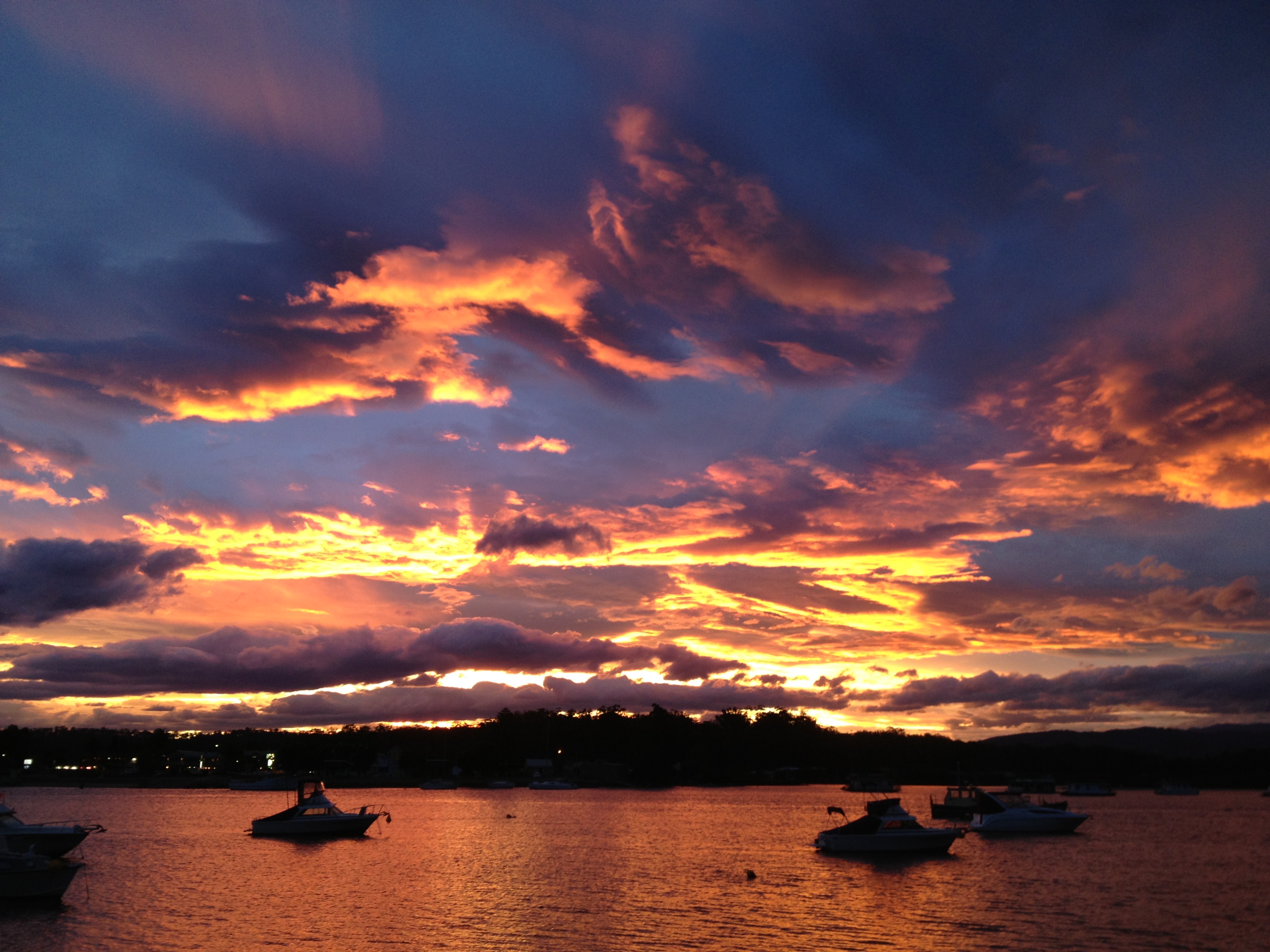
I have hundreds of sunrise and sunset pics from various parts of the world. It’s time to share some of them.
Here’s a watery and glowing goodnight from Batemans Bay, New South Wales, Australia.
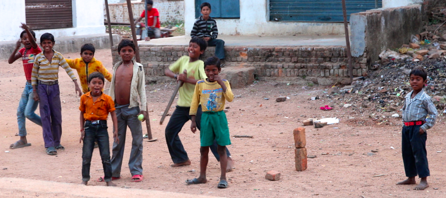
A quick cricket game


We thoroughly enjoyed being in India, and it was particularly refreshing to have people who actually wanted to have their picture taken.
We’ve visited so many places around the world where photo subjects want to be paid to pose. I really don’t’ mind that. Heck, if I want to take their picture, they deserve to get some benefit. Rather like paying a busker.


But India is different. People want to have their picture taken. On more than one occasion, especially when I was slow to raise my camera, I had people, with their lower lip pushed out, ask Don’t you want to take my picture?

More cricket while waiting for the school bus


Yeah, of course, I do. And then they’d strike a pose.
A couple of times, shy women declined my request to photograph them—I always try to ask before I shoot—but all the men and children thought it was fine.


Not many of these pics have (or need) captions. Kids are kids. Aren’t they gorgeous?
P.S. Would love it if you check out my recipe blog—Cooking on page 32.
P.P.S. Click on any image (you may need to double click) to see a larger version.


One of the great things about travelling around India by road is the chance to see people going about their everyday work lives.
Green grocers hawking fruit and veg, women doing laundry (remember I hate laundry), beggars with a hand out asking for a handout, shopkeepers touting their goods, gardeners raking and planting, cashiers ringing up sales, cooks creating feasts, conductors inspecting tickets. I could go on and on.


Unfortunately, too many people in India don’t have jobs. We asked Anand and Deepti about the news we hear in Australia that so many of their country’s university graduates don’t have jobs.
Anand has a theory. He reckons it’s because so many young people don’t study what they love. They succumb to their parents’ wishes (or demands) that they study law, medicine, engineering or some other high profile subject.


Anand is passionate about wildlife and nature. He gives his parents tons of credit for supporting his desire to go to South Africa as a teenager and pursue the three-year course to become a certified game ranger. They thought he was crazy, but they supported him anyway.
Deepti feels the same about her parents’ support, which allowed her to study marketing and move on to become a naturalist, with an immense knowledge of birds.

These two like-minded young people then had the vision and help from their families to start Prayaan India Overland. We were so impressed by their planning, forward thinking, knowledge of their country and its wildlife, willingness to work hard and invest in their venture, and so much more.
But this is beginning to sound like an advertisement for their company. And that’s not what this is supposed to be.


I get side-tracked in real life and, so it seems, in cyberspace, too.
What I really wanted to show was India at work. Most of the pics here are self-explanatory so most have no or only a short caption. I wanted to share glimpses of what we saw during our five weeks in India.


P.S. I noticed that one pic (or maybe more) posted twice. Can’t figure out how to delete, so enjoy them both. 🙂
P.P.S. Click on any image to see a larger version.

Approaching Ranthambore Fort
Ranthambore Fort is one of India’s most impressive monuments, and no one is quite certain who built it and when.
A stone plaque at the site claims it was built by Maharaja Jayanta and ruled by the Yadavas until they were driven out by Prithvirja Chauhan in the 12th century. Other research (and what I read many places on the internet) suggests the fort was started by a Chauhan warrior way back in 944 AD.


It’s unlikely we’ll ever know the exact details, but one look at the fort confirms it was one of the strongest in India. It has an impressive elevated position—700 metres above the surrounding plains—with panoramic views of Ranthambore National Park and even larger tiger reserve.
It is surrounded by massive walls—seven kilometres of them—and has four large gates. History says the fort was so strong and so inaccessible that even the rulers of Delhi and Agra found it a challenge.


But the only challenges we had were climbing the many stairs, chatting with groups of giggling school girls and other ‘pilgrims’, and dragging ourselves out after a half-day of exploring.
You need time to see the fort’s many structures. There are palaces, residential buildings, barracks, temples and a mosque. Luckily the grounds are a wonderful place to walk and, as usual, Poor John walked with his hands behind his back. I’ve said before that this technique is both genetic and catching and, sure enough, Gary adopted it.
Without doubt, the biggest attraction is the Lord Ganesha temple. Located near one of the main gates and not far from the Gupt Ganga, the temple draws ‘pilgrims’ from all over India and the world. They come seeking blessings from Lord Ganesha. Devotees and young couples also send letters to this deity, asking for a specific blessing.


Near the temple, we saw hundreds of stone ‘prayers’. Pilgrims gather stones and build small structures that relate to requests for prosperity, wealth, health, employment and the like.

Prayer stones
The temple is also popular with wildlife. We saw troops of langur monkeys hanging around the place. They do a lot of nit-picking—literally. But they’ve also figured out that they can steal a pilgrim’s offering of marigolds, or be obnoxious enough that a pilgrim will buy an outright ‘donation’ for the monkeys.
Plenty of cows meander around too and we saw a hilarious exchange amongst the beasts. A cow trod on a monkey’s tail. The monkey jumped and whirled around just in time to suspect another monkey of being the culprit. Oh, the mayhem and retribution that followed. We quickly moved away so we didn’t fall among the accused.
Lord Ganesha temple is not far from Gupt Ganga, a perennial spring. In days gone by, Gupt Ganga was a popular place for bathing, and we noticed that nothing has changed. Good for laundry too. Fishing cats like to visit Gupt Ganga, but none showed up while we were there.

Overlooking Gupt Ganga

Bath time at Gupt Ganga
The fort has more water nearby. It overlooks Padam Talao, the largest of three lakes within Ranthambore National Park. The lake is a popular watering hole for tigers, but trees obscure much of the view.
The famous Jogi Mahal Forest Rest House is on the lakeshore. Built as a hunting lodge for members of the royal family of Jaipur, the Jogi Mahal has welcomed VIPs from around the world. Bill Clinton stayed there when he was US president. Sadly, it’s no longer open for tourist accommodation.

My favourite—Cenotaph of Hammir dev Chauhan


But my favourite spot in the fort has to be the Cenotaph of Hammir dev Chauhan. Sitting in the midst of a beautifully landscaped garden, the temple is a visual feast. There are 32 pillars and an eternal flame, which you can only-just see because it is enclosed and underneath the temple’s main platform. A matching, but never-completed, temple is opposite.
If I lived nearby, I think I’d visit Ranthambore Fort regularly. And it was such a wonderful surprise after the previous day’s disappointing game drive in Ranthambore National Park.

Padam Talao with Jogi Mahal in the foreground
A little history

Palace
The fort’s most prominent ruler was King Rao Hammir, the last ruler of the Chauhan dynasty. He reigned from 1282 to 1301, when Ala-ud-din Khilji, the ruler of Delhi, and his army captured the fort. According to legend, thousands of women committed mass suicide to avoid falling prey to the invading soldiers.
The fort changed hands several times over the next three centuries, until it was captured in 1558 by the Mughal emperor Akbar. The Mughals remained in power until the 18th century when they gifted the fort to the Maharaja of Jaipur.
The surrounding forest became royal hunting grounds, which set them on the path to becoming the national park after India gained independence.
P.S. Be sure to check out Cooking on page 32. Some Indian recipes are coming soon.

Farewell to Ranthambore Fort
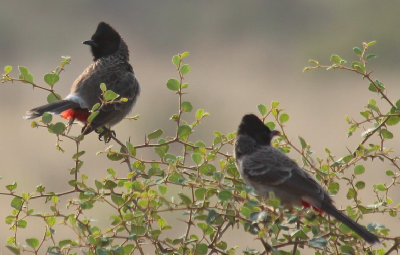
Red-vented bulbuls
We’d heard all the hype about Ranthambore being the top tiger reserve in India, but our little group thought it was poorly organised and not really tourist-friendly.
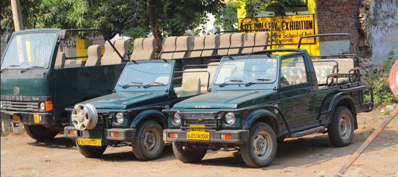
A canter on the left with two Gypsies
For starters, Anand found it impossible to book a Gypsy (a little 4WD) at a reasonable price, so all three of our safari drives were going be in a 20-plus-seater canter. We’re not exactly sure how the vehicle booking system works at Ranthambore, but Anand speculated that a ‘middle man’ might book out the Gypsies and then charge scalper prices for hiring them out.
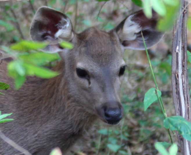
Young sambal deer
Unfortunately, a canter could be more accurately called a bone crusher. They’re uncomfortable to begin with and not made for Ranthambore’s extremely rough roads. Plus our drivers had a cavalier approach to driving. Management at other tiger reserves must think canters aren’t the way to go, because only two parks in the country use them.
Disappointingly, Ranthambore has shorter hours too. Parks we’d visited earlier opened at sunrise or soon after, with safari drives that lasted anywhere from three to six hours.
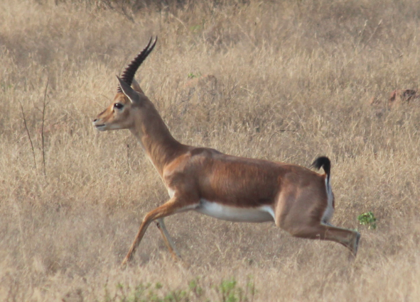
Indian gazelle
But Ranthambore’s gates don’t open until 7:30. The zone we were to visit was simply a drive in and out, following the same route both ways. We were heading back to our campsite by 9:45.
Of course, India’s tiger reserves aren’t zoos and there’s no guarantee you’ll see anything, so we can’t complain about not seeing a tiger there. But we can whinge about the fact the drive in and out were so fast that our chances of seeing tigers were unfairly reduced.


So we looked forward to our afternoon drive. It got off to a ridiculously bad start. The canter arrived an hour late, and then waited another 20 minutes for a knucklehead passenger who stood in the distance chatting on his mobile phone. He finally boarded—all smiles and arrogance. Gary snidely said something like, Thanks mate, nice work holding everybody up. In response, the fellow flipped Gary the bird.

Spotted deer
Anand shot into action. He leapt to the front of the canter and confronted the fellow (who happened to be an Indian) in Hindi. He reminded the guy that the gesture was considered a chargeable offence in India, and would not back down until the fellow apologised to Gary.
It certainly wasn’t a heartfelt apology, but it put the matter to rest. It was also obvious that the fellow’s travelling companions were not impressed by his behaviour.
So after a late start, we hoped to have a late finish, but no! It was another shortened version over the same road we’d covered in the morning.
I did get some good wildlife pics—mostly of animals and birds we’d seen in Panna, Pench or Kanha. We saw our first Indian gazelle at Ranthambore, and also our first red-vented bulbuls.
But the really big bonus came as we neared the exit. That’s when Poor John spotted a sloth bear off to our left. It trundled itself into the bush so fast I couldn’t get a pic, but we were thrilled to see it. We were sitting at the very back of the canter, and don’t know whether all the others even saw it. They didn’t seem to react. In case you didn’t know, Baloo, Mowgli’s best friend in Rudyard Kipling’s Jungle Book, was a sloth bear.
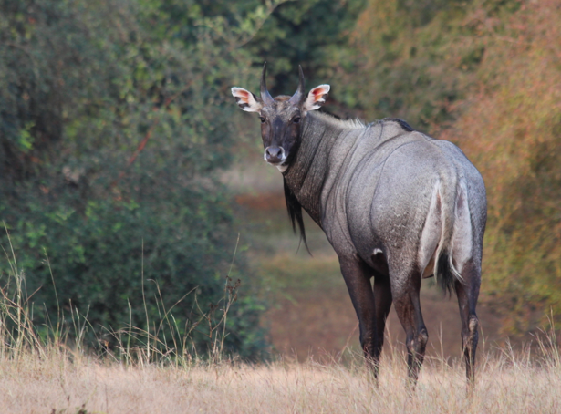
Male nilgai

Female nilgai
Back at the campsite, we had a little group discussion and agreed to pass on the third safari drive. The next day we would get a mini trip through the grounds when we drove (in a Gypsy) to the Ranthambore Fort which is located within the greater national park.
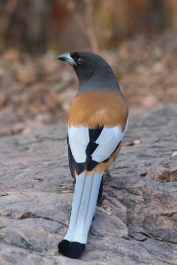
Rufous treepie
Anand and Deepti promised that we could make up the lost drive in another reserve. I like to think the replacement was the third drive in Rajaji when we saw three leopards.
But to be honest, our time in Ranthambore wasn’t a complete write-off. In addition to a couple of new species, we saw a local dance performance, had an authentic Rajasthani meal and visited the fabulous Ranthambore Fort, which which I’ll write about next.
P.S. I know that lots of people have had wonderful experiences in Ranthambore, but we were generally disappointed. I posted a review of our canter problems on Trip Advisor and, within a couple of days, a woman wrote to say I’ve just come back and due to a maniac driver have a severely injured right knee. Just want to say ‘thank you’ for your posting as it confirms that I’m not going mad! She definitely isn’t going mad and it makes me think our experience may happen too often.
P.P.S. So if you go to India, think twice about spending the money to visit the tiger reserve at Ranthambore, but don’t miss the fort.
And if all this reading has made you hungry, please check out my cooking blog.
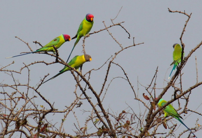
Plum-headed parakeets. The males have the redder heads

The Sudan (especially South Sudan) could be Africa’s breadbasket
South Sudan has been in the news lately—sadly because of internal conflict—but the media attention brings back memories of my amazing travels there in the 1970s.
Back then, a friend, Don, and I took about five weeks to traverse the north-to-south extremes of The Sudan. Back then, it was the largest country in Africa, and we covered about 3000 kilometres of it, starting in Wadi Halfa (near the border with Egypt) and finishing in Juba (in the deep south).

Life in The Sudan is still simple
I promise to write more about that trip in general, but for the moment my mind focuses on The Sudan because I encountered another blog by people who lived in The Sudan in the 1980s.
James and Terri have a wonderful travel blog that I’m working my way through. If you enjoy my tales, you’ll enjoy theirs too.
Their talk of The Sudan reminded me that I should share a couple of poems I learnt in Kenya more than 35 years ago—when life wasn’t very politically correct.
Bill Swinson (an old hand from the British days in The Sudan) shared these poems with us when we met him in Nairobi in 1977. He had worked in soil and water conservation in The Sudan for five years. I can’t remember how he came to have the collection, but he said the poems had been penned by English men and women who worked in The Sudan in earlier decades.

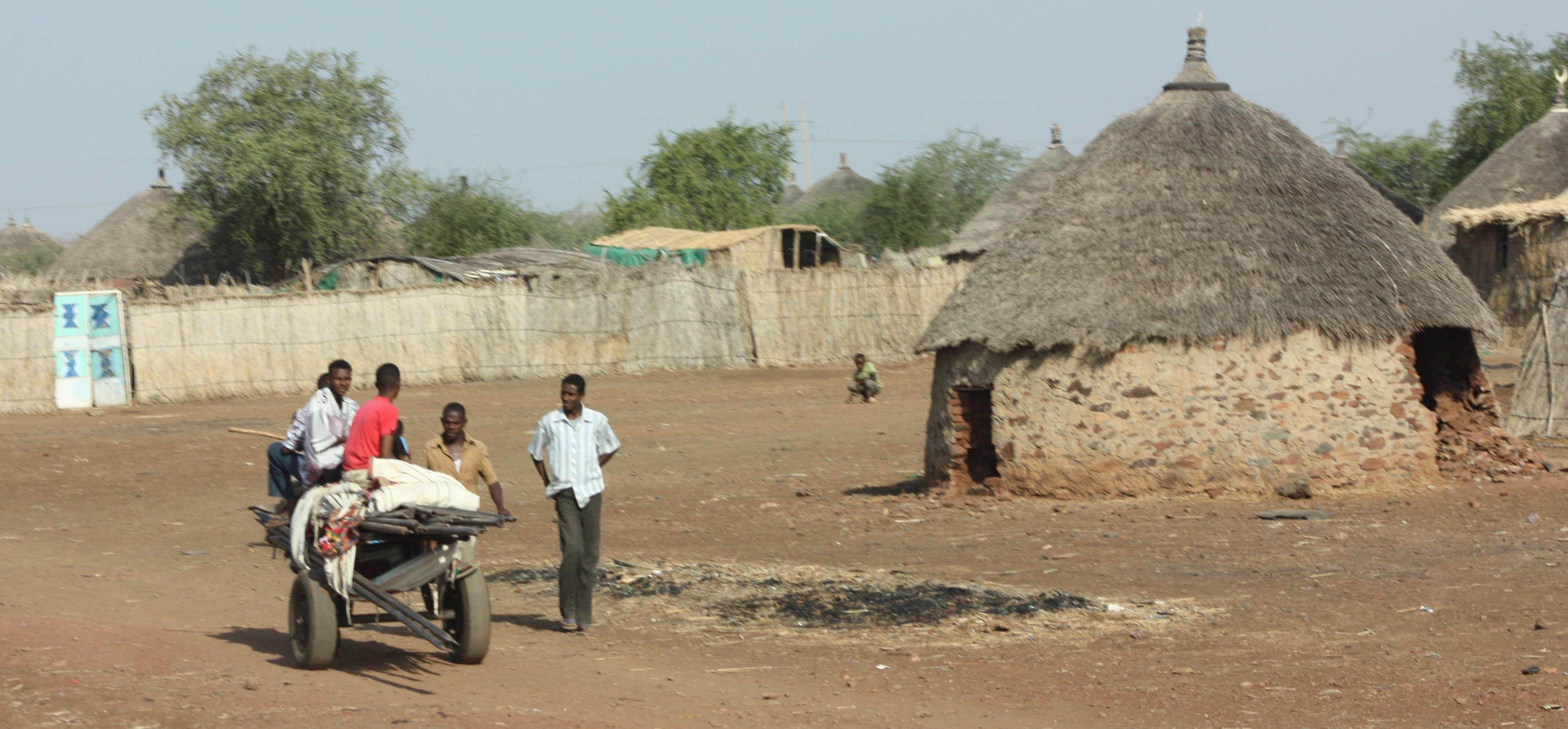
Grain storage in The Sudan in the 21st century. Note the traditional huts in the foreground
Bill had lots of interesting stories, but this one sticks in my mind. After one harvest, Bill worked hard to convince the Africans in what is now South Sudan to bury their grain and sell it later when times where harder and food was scarcer for the northern Arab Sudanese. His plan worked, which brought some much needed income to the locals and made Bill not very popular with the Arabs.
So here are the poems. The first appears nowhere else on the internet, and the second occurs only once. I posted it in 2009 when I was travelling on an overland trip with African Trails. Please don’t copy and paste this all over the internet. If you want to share it, link back to this post so that the history of it remains intact. Thanks.
For full effect, please read the poems aloud and with gusto.
P.S. The Sudd is a vast swampy area of the Nile. Malakal and Shendi etc. are towns and villages from which the British departed to go on their annual holidays in the UK.
P.P.S. I know both these poems by heart and can perform them as a party trick.
P.P.P.S. I know it’s outdated, but I still call The Sudan, The Sudan. Does anyone else, or is it just me?
Sudanese National Anthem
It is a bloody country, it is a blood-stained land,
with miles of desolation and tons of red-hot sand.
There are millions of mosquitos and a thousand miles of mud,
but the sanguinary prefix is best applied to Sudd.
When God in all his glory, let loose the following Nile,
he winked a cunning optic and smiled a knowing smile.
He said, ‘I’ve done it this time. I never did create,
such a bloody awful country in to God’s estate.’
From Malakal and Shendi, Meshra, Renk and Bor,
from Korda. Wau and Juba, we’ll board that boat once more.
And leave this bloody country, to those whose aims would be
to love their dusty brothers much more than you and me.
And when we hand our chips in, before the pearly doors,
with many a boon companion, old friends, old flames, old whores,
Saint Peter, he will mutter and murmur, ‘Oh well, well,
let the bastards in to heaven, they’ve spent their time in hell.’

A Sudanese community looks after its harvest
Where the Dinka’s Doo-dad Dangles All the Day
In that grim and gaunt Sudan
Home of prehistoric man
Where slimy crocodiles await their prey
Lying prone upon the mud
In that everlasting Sudd
Where the Dinka’s doo-dad dangles all the day.
Where the Nile is mis-named white
And mosquitos ping and bite
And hippos grunt and gurgle as they play.
In the middle of the mud
That everlasting Sudd
Where the Dinka’s doo-dad dangles all the day.
Where the white man sweats and sings
Til that welcome tsetse brings
A sleeping touch of permanent decay
Where the best of pink gins pall
In that land of sweet damn all
Where the Dinka’s doo-dad dangles all the day.
A glimpse of a Sudanese village
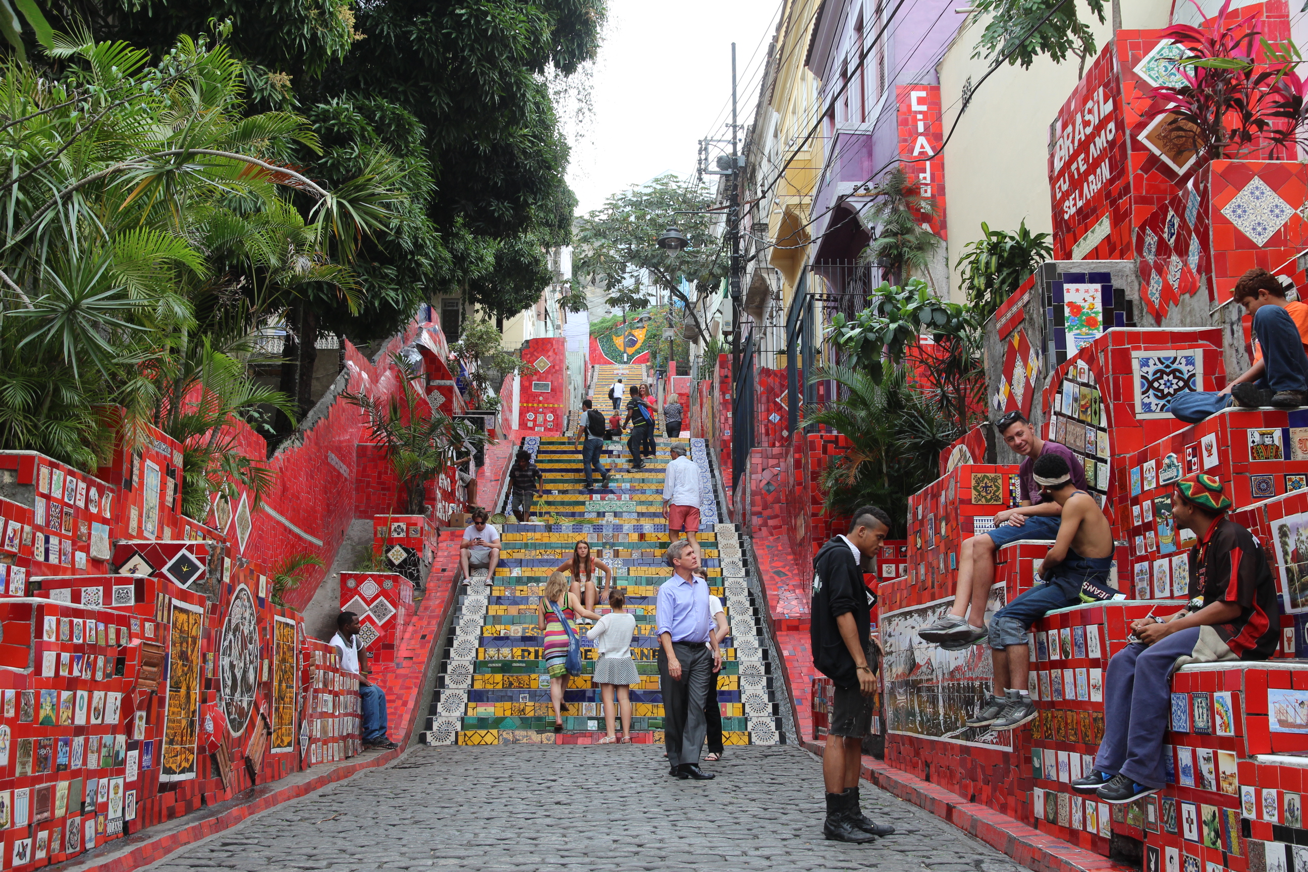
Tourists and locals enjoy the Lara Steps
Rio de Janeiro is all about the beaches, parties, music, dance, food, drink, energy and colour.
And when it comes to colour, there’s no place in Rio that is more colourful than the incredible and beautiful Lapa Steps.
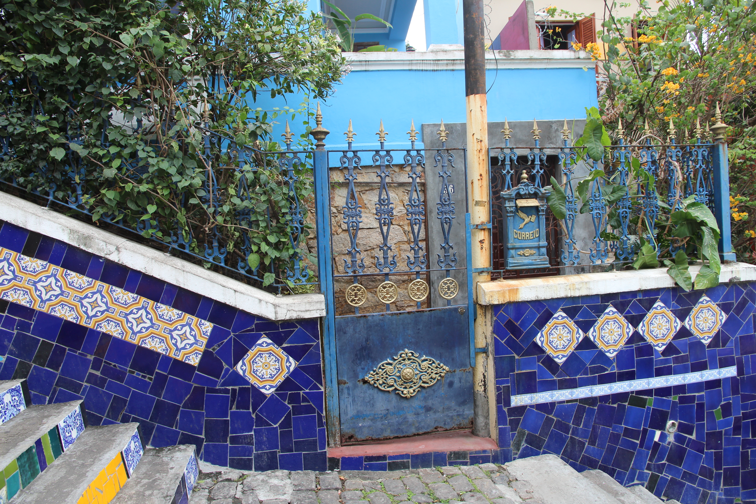
Blue house on steps

Red house on steps
Of course, the steps have been there for yonks—they lead to the Convent of Santa Teresa—but the colour didn’t start to appear until 1990. That’s when Chilean-born artist, Jorge Selarón, decided on a whim to create a ‘tribute to the Brazilian people’.
His tribute would develop on his doorstep. Selarón’s house was located on the stretch of dilapidated steps that connected Joaquim Silva and Pinto Martins streets. His plan was to renovate this 125-metre staircase with pieces of tiles that reflected the main colours of the Brazilian flag—yellow, blue and green.
At first, he scrounged tiles from construction sites and urban waste, but as transformation progressed, people from all over the world sent and brought tiles—many handcrafted by the sender/bearer—for Selarón to add to his creation.
Today the staircase displays more than 2000 tiles, ceramics and mirrors from more than 60 countries. Red and yellow are the dominant colours, and there is a recurring image of a pregnant African woman. Selarón hand-painted about 300 tiles showing the woman, but never explained the image’s significance except to say it related to a personal problem from his past.

Red is a dominant colour on the side walls
Selaron funded his obsession with the stairs by painting and selling potraits—he claimed to have done 25,000 depicting the pregnant woman. He also accepted donations. I was told that Selarón commissioned the tiles he used to recreate the Brazilian flag because he wanted the colours to be exactly right. We did not meet him, but people say Selarón was friendly and personable, if eccentric, and liked to chat with tourists.


Explanatory panels by Selarón, with English on right (click on the smaller images above to read)
There are two large explanatory panels near the bottom of the stairs—one in English and the other in Portuguese. On the English one, Selarón calls his work ‘The Convent Stairway’ but today the locals call it Escadaria Selarón, or Selaron’s Stairs.
The stairs have received a lot of international coverage, including the National Geographic channel, Time, Playboy and The Amazing Race. They also featured in Rio’s bid for the 2016 Summer Olympics.

Brazil’s flag in ceramic tiles
I was saddened to learn that Selarón, who was 65 at the time, was found dead on his beloved stairs just a few days after our first visit to Rio.
Friends said he had been depressed in recent times, but police confirmed that Selarón had also received death threats. As far as I can determine, there has been no final decision as to whether his death was suicide, homicide or natural. Such a tragic ending for someone who brought so much colour, life and respectability to a neighbourhood that, until recently, was considered to be quite rough.
Selarón and his fabulous artwork were admired by his adopted city. In 2005, he was made an honorary citizen of Rio and the Lapa Steps were declared a city landmark.
P.S. Of course, Poor John (aka He Who Walks Everywhere) and I went to the top of the stairs.


Sugarloaf Mountain (Pão de Açúcar) seen from Morro da Urca
After several years of roaming the world on New Year’s Eve, this year we enjoyed a lazy and home-based time at Rosedale beach on Australia’s southeast coast.
We watched the live coverage by the ABC, Australian national broadcaster, which included interviews with personalities (there was even one with Reg Mombasa) and lots of snippets relating to previous New Year’s Eves.
It brought back wonderful memories of our 2012 New Year’s Eve in Rio de Janeiro.

Looking down to Urca Beach and surrounds
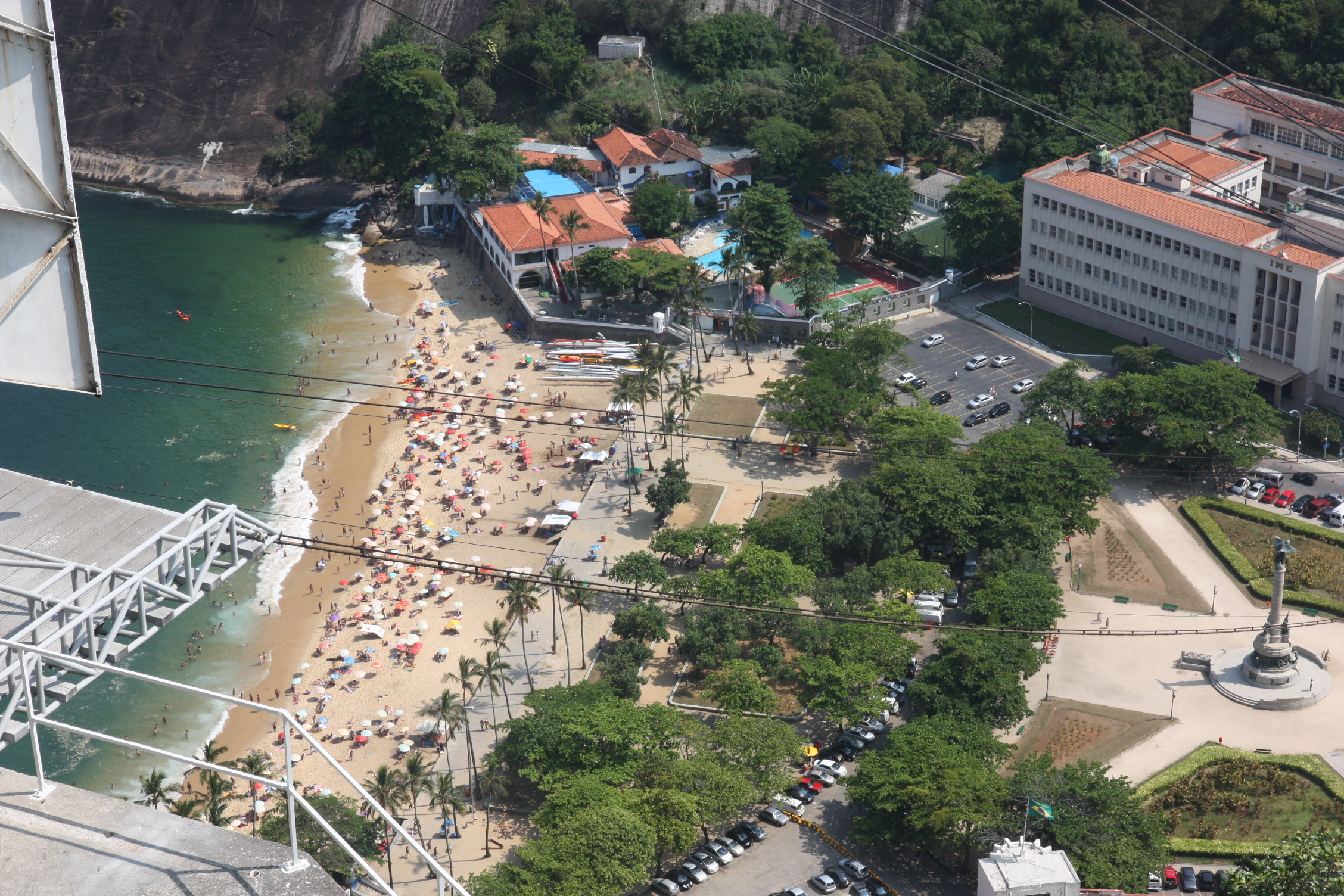
Urca Beach
That day, Poor John and I set out early on foot from where we were staying near Flamengo Beach. We were on our way to see Rio’s amazing Sugarloaf Mountain.
Sugarloaf sits at the mouth of Rio’s large Guanabara Bay, on a peninsula that juts into the Atlantic Ocean. It is one of several monolithic granite–quartz hills in the city that rise straight from the water’s edge. It’s almost 400 metres tall (1300 feet), and the fittest and most adventurous can actually climb the rock.
After walking five kilometres and standing in the entrance queue for about 90 minutes, Poor John and I opted for the two cable cars to the top. The first leg ascends to Morro da Urca, which is 220 metres high. The second ascends to Pão de Açúcar (sugarloaf in Portuguese) itself.
Views—from both the top and the glass, bubble-shaped cable cars—are sensational and pretty much 360 degrees. The city, its beaches, its ritzy suburbs and its waters spread out before us. I wonder how many people have made it to the top of Sugarloaf. There’s been a cable car arrangement there for 101 years.
The Portuguese coined the name Sugarloaf back in the 16th century when Brazil’s sugar cane industry was first flourishing. They thought the mountain looked like the conical clay moulds that held blocks sugar that were to be shipped from Brazil.
We explored every corner of the peak and managed to fill the whole day, until it was time to buy supplies for the after-dark celebrations on the beach with a group of our fellow overland travellers. Lots of wonderful memories and a fantastic start to 2013—which was a very good year too.
Wishing you all a happy and prosperous new year—wherever you are and whatever you do.


