
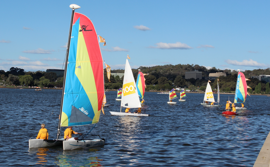
Kata Tjuta (The Olgas) always seems to come off as Uluru’s poorer sister—and the neglected one. Lots of people who visit Uluru, speed away before taking time to go ‘round the corner’ to see The Olgas. Surprising, because the two places are less than 50 kilometres apart.
So now it’s time for a closer look at Kata Tjuta.
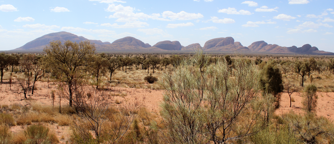
This place—made of congomerate—is even bigger and, in many ways, more impressive than Uluru. Its 36 domes of sedimentary rock consist of cobbles and boulders. The domes cover almost 22 square kilometres, with the tallest (Mount Olga) rising more than 500 metres above the surrounding plain.
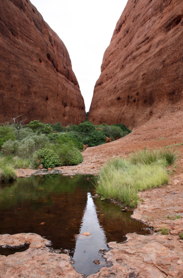
Walpa Gorge
Kata Tjuta is sacred under Tjukurpa and Anangu men’s law, but the public is encouraged to enjoy its sunrises, sunsets and two spectacular walks—the Walpa Gorge and the Valley of the Winds.
The Walpa Gorge is just over 2 1/2 kilometres round-trip and takes about an hour. It’s a fairly easy walk, once you get past the slope at the beginning.
The Valley of the Winds walk, which was partially closed when we were there this time because of high temperatures, has three parts. A return trip to Karu Lookout is a moderate walk that takes about an hour. The track is closed beyond this point when the temperature exceeds 36°C (97°F). The mercury range from 43–46°C (109–115°F) when we were there.
But when it’s cooler and if you have up to four hours to spare, you can tackle the more difficult walks to Karingana Lookout or carry on for the full circuit of 7 kilometres. The views really are spectacular but, because of the heat, I don’t have photos from this visit. Maybe I can find some good ones from 2011.
Kata Tjuta (and Uluru) are steeped in Dreamtime legends. Many relate to the great snake king, Wanambi, who is said to live on the summit of Mount Olga. Apparently he comes down only in the dry season. It was plenty dry when we were there, but he didn’t make an appearance.
As an aside, in case you’re wondering about the site’s name—explorer Ernest Giles named The Olgas in 1872, to honour Queen Olga of Württemberg.
This changed in 1993 when Australia adopted a dual naming policy, meaning this landmark (along with Uluru) had official names that included both the traditional Aboriginal name and the English name. For 10 years, the order of the names was English/Aboriginal, but the order was swapped in 2002. The name Kata Tjuta means ‘many heads’.
Uluru–Kata Tjuta National Park is a World Heritage site. It is one of few such sites in the world to be recognised for both natural and cultural importance.
If you get there, be sure to visit in the cultural centre. It has lots of interesting information and insight, simply and sensitively explained. And there’s some amazing artwork in the gift shop. Wish they allowed photos.
We get a lot of visitors at our beach house on the southeast coast of Australia.
Aunt Esther gave us a thick visitors’ book not long after the house was completed in the early 1990s. There are just a handful of blank pages now. Plus there are four shoeboxes full of homemade napkin rings.
I love cloth napkins, so get each visitor to make a napkin ring, using a cut-down toilet paper roll and lots of glitter, textas (markers), crayons and such. Then everyone gets issued a napkin that’s used for the duration of their stay. Note to self: do a picture parade of memorable napkin rings.

That said, I can’t get all the visitors to make one. This pole house in the trees is a popular spot for all sorts of wildlife. We’ve seen kangaroos, echidnas, goannas, sugar gliders, possums and a whole range of birds.
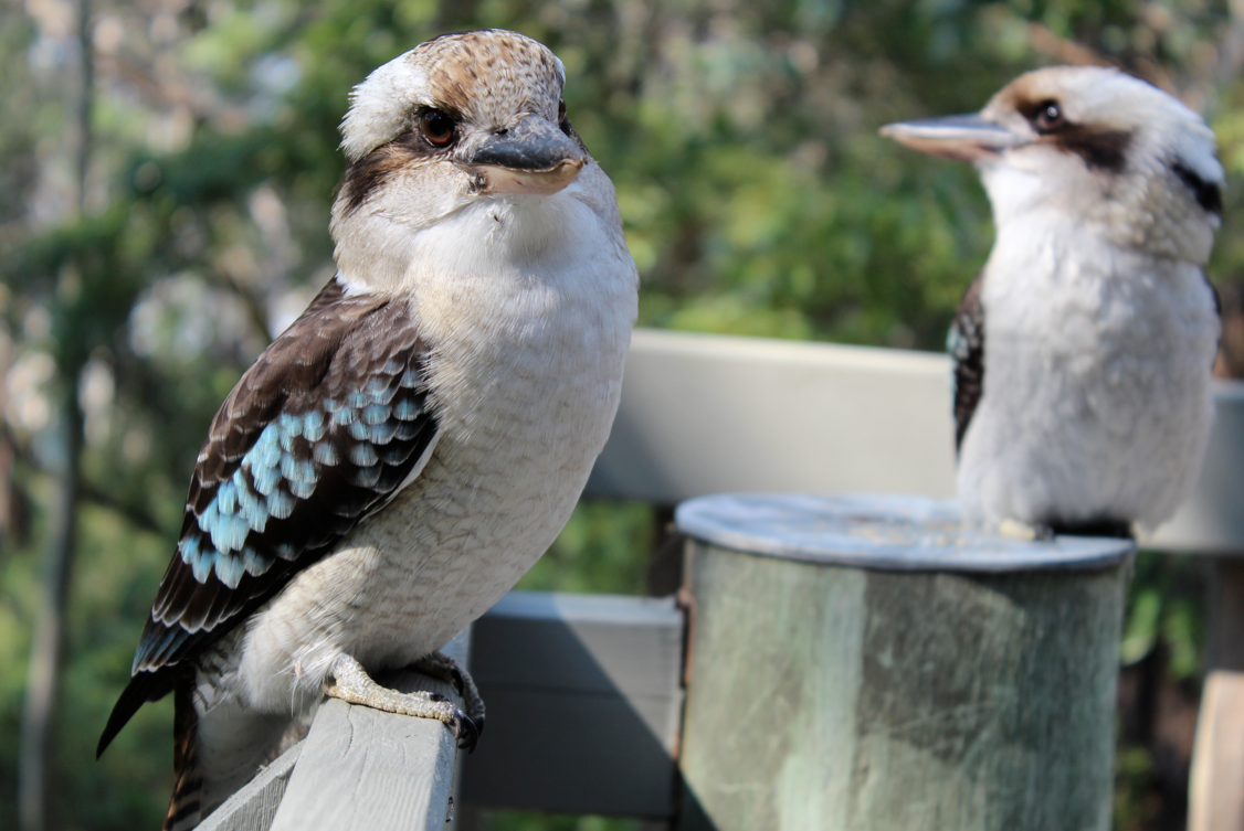
This last weekend, two laughing kookaburras landed on our front deck. They popped in two days in a row and spent both afternoons chuckling and looking hungry. I admit that we fed them a bit of leftover chicken. I assured them that it would taste just like ‘snake’.
Besides being good laughers, kookaburras (also known as kingfishers) are carnivores. They usually eat mice, snakes, insects, small reptiles and smaller birds, but are also quick to steal meat off an unattended barbecue.
Our visitors were still sitting on the deck railing the day I left to drive back to Canberra. I rather hope they haven’t stayed to peck away at the cedar window frames. As cute as they are, it’s still another offence they commit.
P.S. I was about a metre away from the birds when I took these photos.
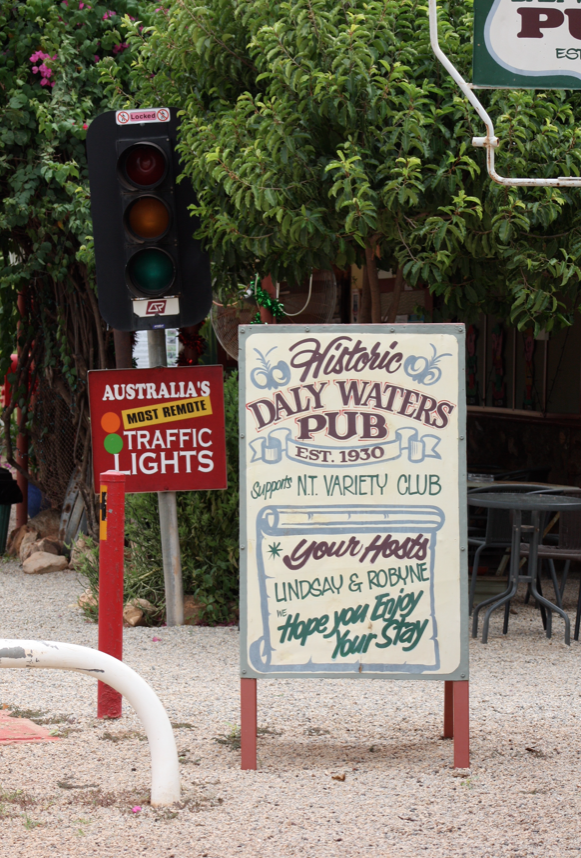 Daly Waters was one of my favourite stops as we travelled from Darwin to Sydney, as part of our bigger London to Sydney overland adventure.
First settled in 1861, this place is wonderfully quirky in every way—from Australia’s remotest traffic light to its award-winning pub that serves very cold beer and great food, has regular entertainment and the THONG TREE.
For Australians, thongs are those rubber things you wear on your feet. But for much of the rest of the English-speaking world, thongs are those slingshot-style (and probably ill-fitting) underpants.
On our overland road trips—with lots of English passengers—I get a kick out of using the word ‘thongs’ in almost every sentence. Do you like my thongs? Where are my thongs? I need to buy new thongs. My favourite thongs are green!
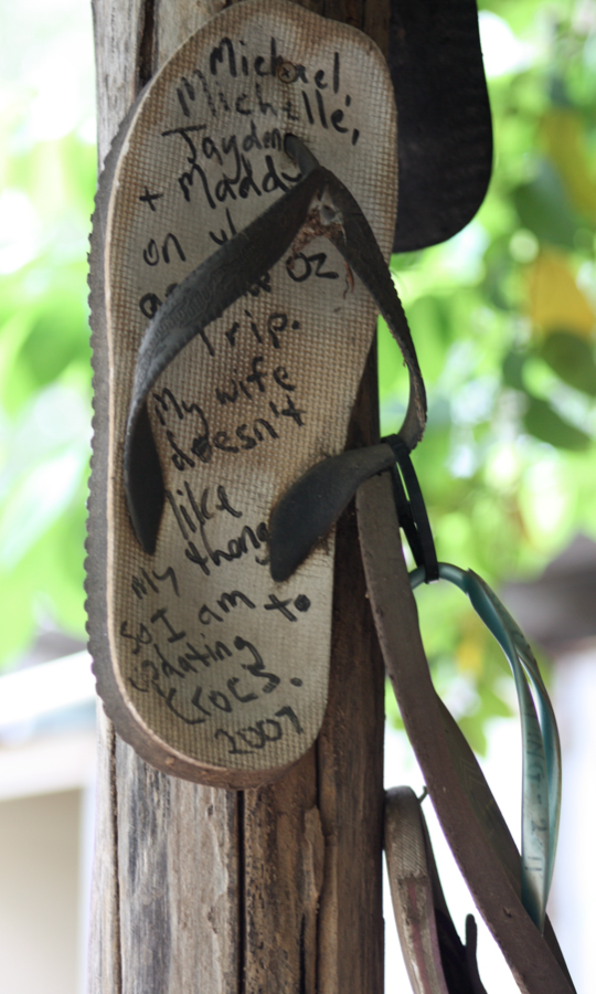
The Daly Waters Pub is well aware that thongs get a shellacking. They are misunderstood and underappreciated in many parts of the world, so out the back of the pub, and in support of the lowly thong, you can add your footwear to the heavily decorated tree.
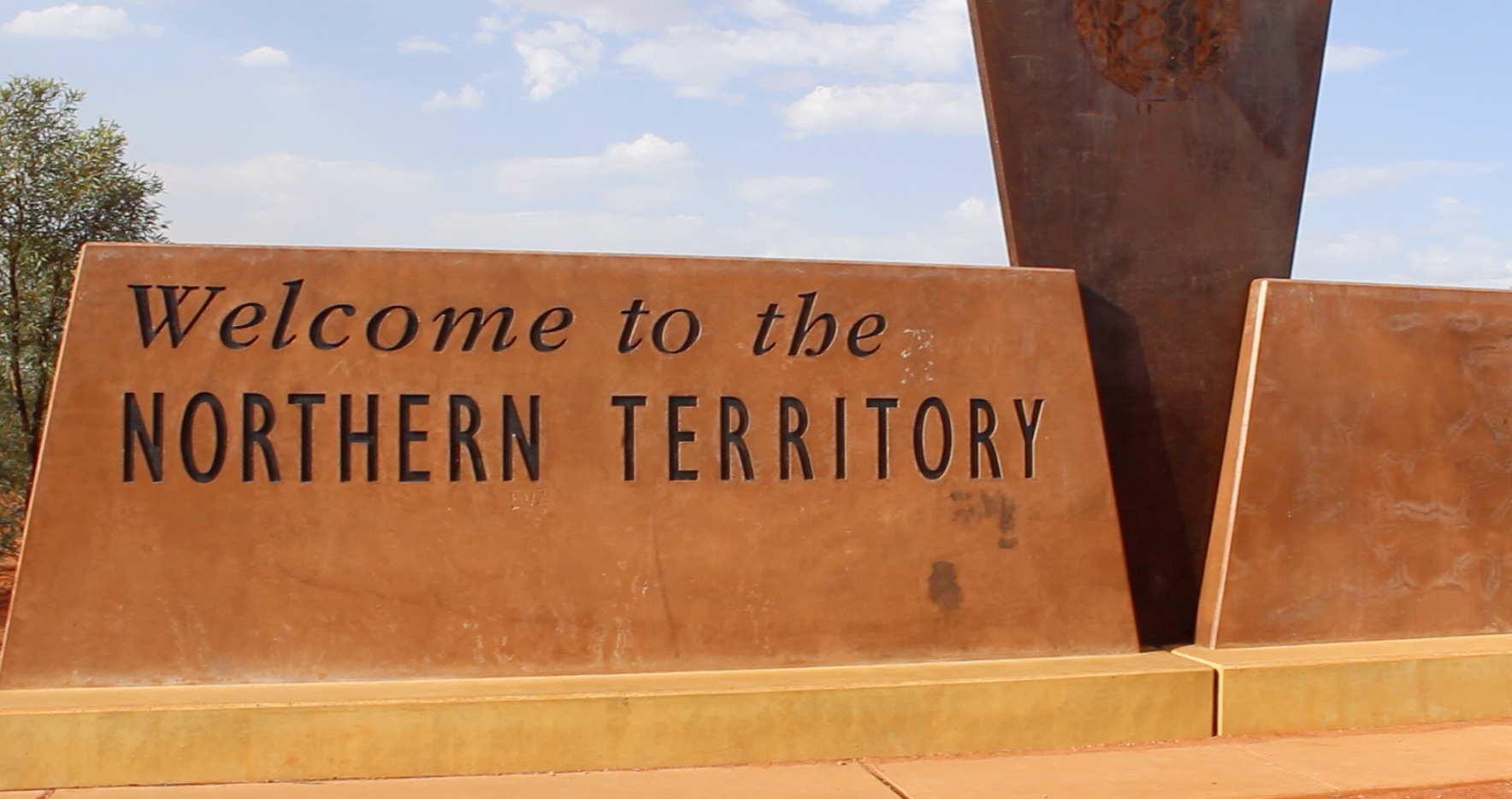
If you have some spare thongs to add (see the P.S. below for the background), you’ll find the Daly Waters Pub just off the Stuart Highway in Australia’s Northern Territory, which is rather fitting. The settlement was named by explorer John Stuart on his third attempt to cross the continent from south to north. He made it all the way from Adelaide to Darwin in 1862.
P.S. In case you can’t read the Thong Tree poster, here it is. I’ve corrected the spelling.
‘Australia’s First Thong Tree
‘Due to the introduction of exotic species such as reef sandals and the swedish masseur, the native thong which can be found throughout Australia has experienced a drastic reduction in numbers over the last decade.
‘We at Daly Waters are attempting a captive breeding program. If you would like to make a donation and assist us by increasing the gene pool, please see the bar staff.’
It’s more than 10 kilometres and it’s worth every step. I’m talking about the walk around the base of Uluru (Ayers Rock).
The first time I did this walk was in February 2000. Five of us flew there, including friends from the USA, one of our daughters, our very first exchange student, Jean-Mi from Belgium, and me. Poor John got left behind to work, and look after Aunt Esther (more about her someday) and the dog.
Jean-Mi had arrived two days earlier, from a cold and snowy Europe. Within 48 hours we were in 45°C weather and he was saying it was ‘the hottest I’ve ever been in my life’. It was also the day he learned that wearing sunscreen and a hat makes a whole lot of sense—and that wearing sandals and socks is just not done in Australia.

Three of us thought about climbing the rock, but realised our shoes and water bottles weren’t up to the effort. So in addition to doing the Mala Walk, we chose to walk around the rock—the whole thing.
The perimeter of the actual base is only 9.4 kilometres, but the walking route is a little longer at 10.6 kilometres. Some of the walk skirts around highly sensitive areas that the Anangu people believe shouldn’t be viewed and/or photographed.
These areas are part of Tjukurpa and Tjukuritja.
Tjukurpa (pronounced chook-orr-pa) is the foundation of Anangu culture and refers to the creation period when their ancestral beings created the world. It tells of the relationship between people, plants, animals and the physical features of the land. It also provides answers to questions about rules for behaviour and for living together.
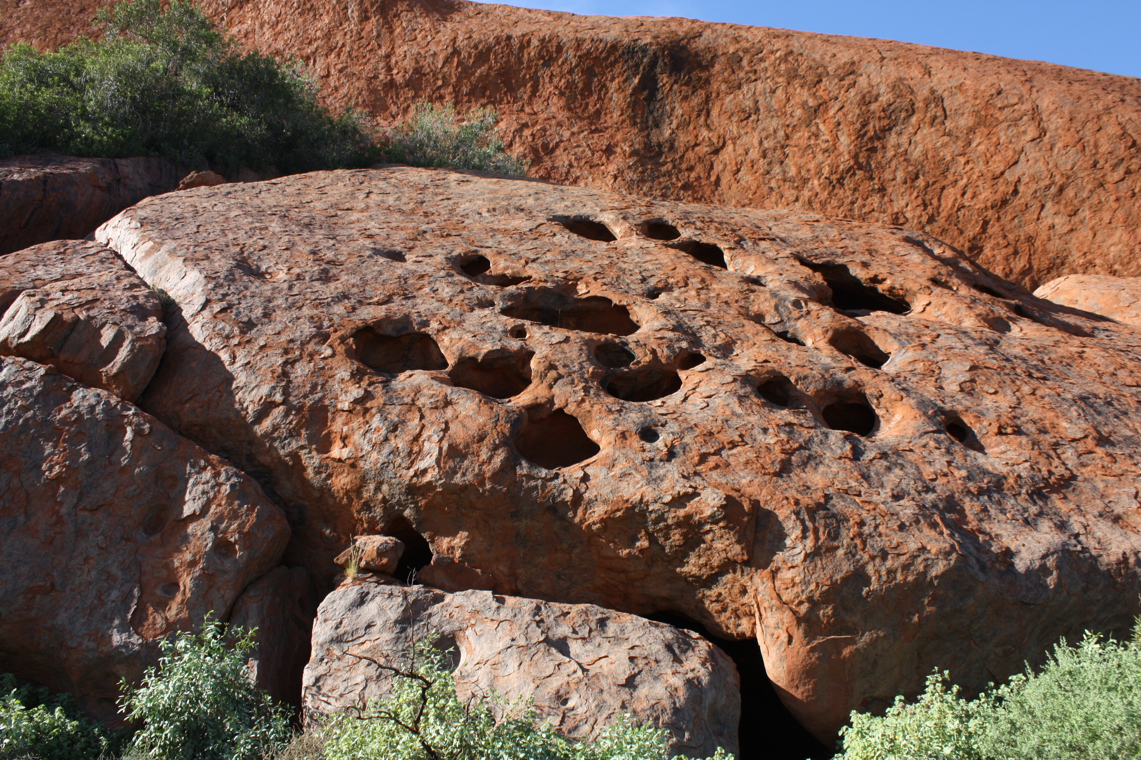
Tjukuritja is the physical evidence that the ancestral beings created the world—meaning the trees, rocks, caves, boulders, cracks, waterholes and more. The Anangu believe the ancestors and their spirits still inhabit the land. And when you walk the base, you can’t help but feel they are right.
So here are some more of the views you’ll see when you do the entire base walk.
I call this the sleeping lion
There are plenty of ways to get up-close-and-personal with Uluru without climbing it.*
In fact, there are five special tourist walks that each take 90 minutes or less and are deemed to be easy and even wheelchair-friendly. A sixth walk is the full circuit of the rock’s base. That is just over 10 kilometres and takes anywhere from 3 to 5 hours. I’ve done that walk in 4 hours and Poor John has done it in less—me in the year 2000 and him in 2011. It was blisteringly hot both times.
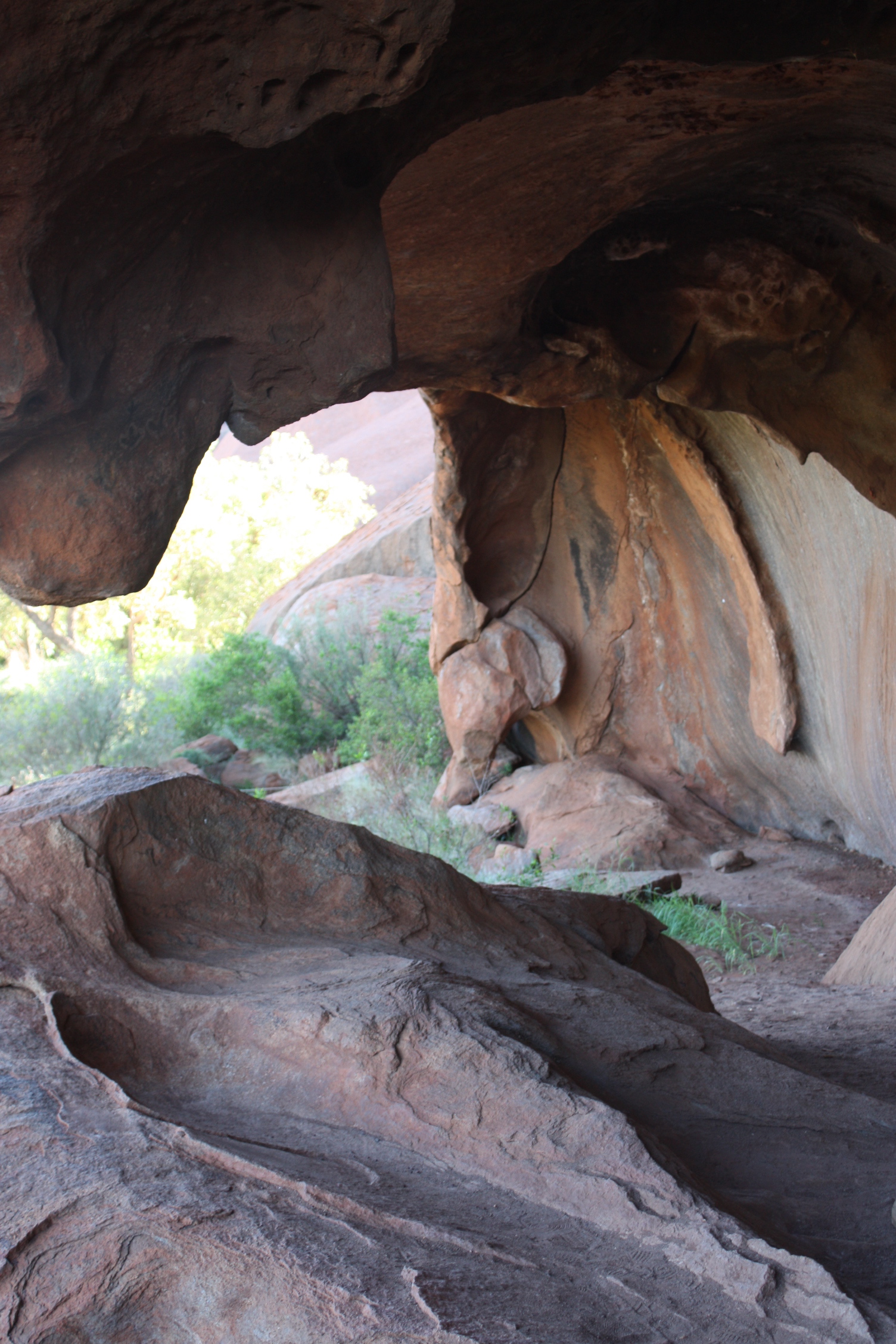
Kitchen cave
I’ve also done all the other walks, but every time I’ve been to Uluru I’ve managed to do my favourite, the Mala Walk. It starts near the beginning of the actual rock climb, and takes only 45–60 minutes on your own, or up to two hours with an Aboriginal guide. Guides are amazing and they share a wealth of information, but they dawdle. The posted signs are helpful too if you have limited time.
Either way, the walk introduces you to how the rock has been used for centuries.
The Mala Walk ends at the Kantju Gorge, but along the way you see many caves that have historical importance for the Anangu—such as the kitchen cave, the old people’s cave and the teaching cave.
There’s plenty of flora and fauna too. My favourite is the bloodwood tree, which is perfect for making didgeridoos. In case you didn’t know, didges are not hollowed out by hand. Aborigines let termites do the work for them.
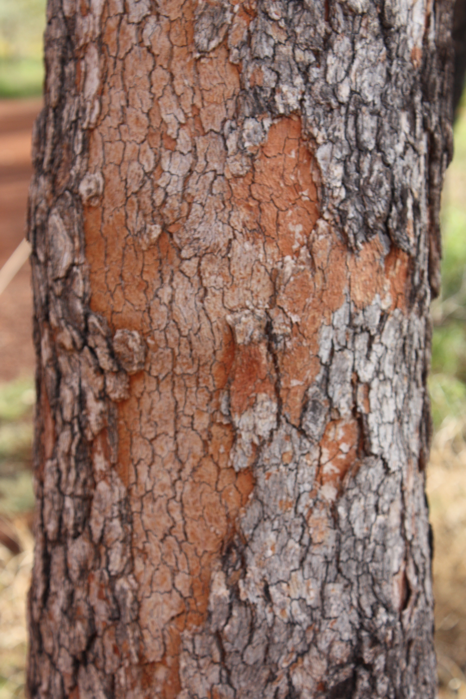
Bloodwood tree
Other good walks are the Kuniya Walk, the Lungkata Walk, the Liru Walk and the Dune Walk.
If you ever get to Uluru, you’ll get plenty of brochures and guides for all sorts of activities. Do the walks—any and all of them. And please respect the requests to not photograph or walk by sensitive areas. We are their guests!
If you feel you have to climb, be sure to wear sturdy shoes and take enough water.
As an aside, park entry costs $25 for three days. This price covers Uluru and Kata Tjuta (more about that soon) and the cultural centre. Be sure to visit the centre, but remember that no photos are allowed. Lots of wonderful explanations and great artwork for sale. Don’t miss it!
* To climb or not to climb?
Uluru rises 348 metres (equal to about a 26-storey building) above the surrounding red plains. Thousands of tourists have climbed it since 1958, and more than 35 have died doing so. Many more have been injured.

You want to climb that?
The climb is closed when it’s too hot, too rainy, too slippery or when there are Aboriginal cultural occasions. It’s open the rest of the time.
I’m not criticising people who do climb. It really is an individual choice.
But you need to know that the Anangu people, traditional owners of the rock, don’t want people to climb. For starters, the rock is extremely sacred to them. It’s plays an important part in their Dreamtime lore.
Plus they say the Anangu suffer when someone dies climbing the rock. It’s rather like having someone fall down dead in your backyard.
I’ve signed an oath that I will never climb. That might have been different if the first time I was there it hadn’t been 45°C (or 113°F).
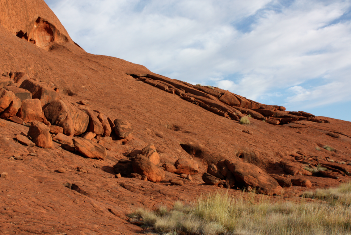
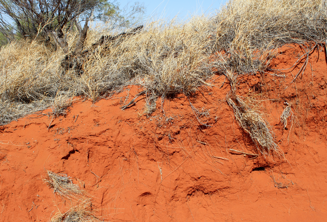
Some texture of Uluru
Pinching (stealing) things from Uluru
It’s very tempting to take things from the Uluru-Kata Tjuta National Park. A bit of rock, a scoop of sand, a twig or more. It doesn’t matter. No one will notice.
But they do notice and you’ll notice too. There’s a sort of visitor’s book in the cultural centre that’s loaded with letters from people sending back bits of rocks and surrounds that they pinched .
Many have suffered a lot of misfortune since taking te bit of rock. They are trying to make amends. So for your own well-being. Don’t take it to begin with. Just saying!

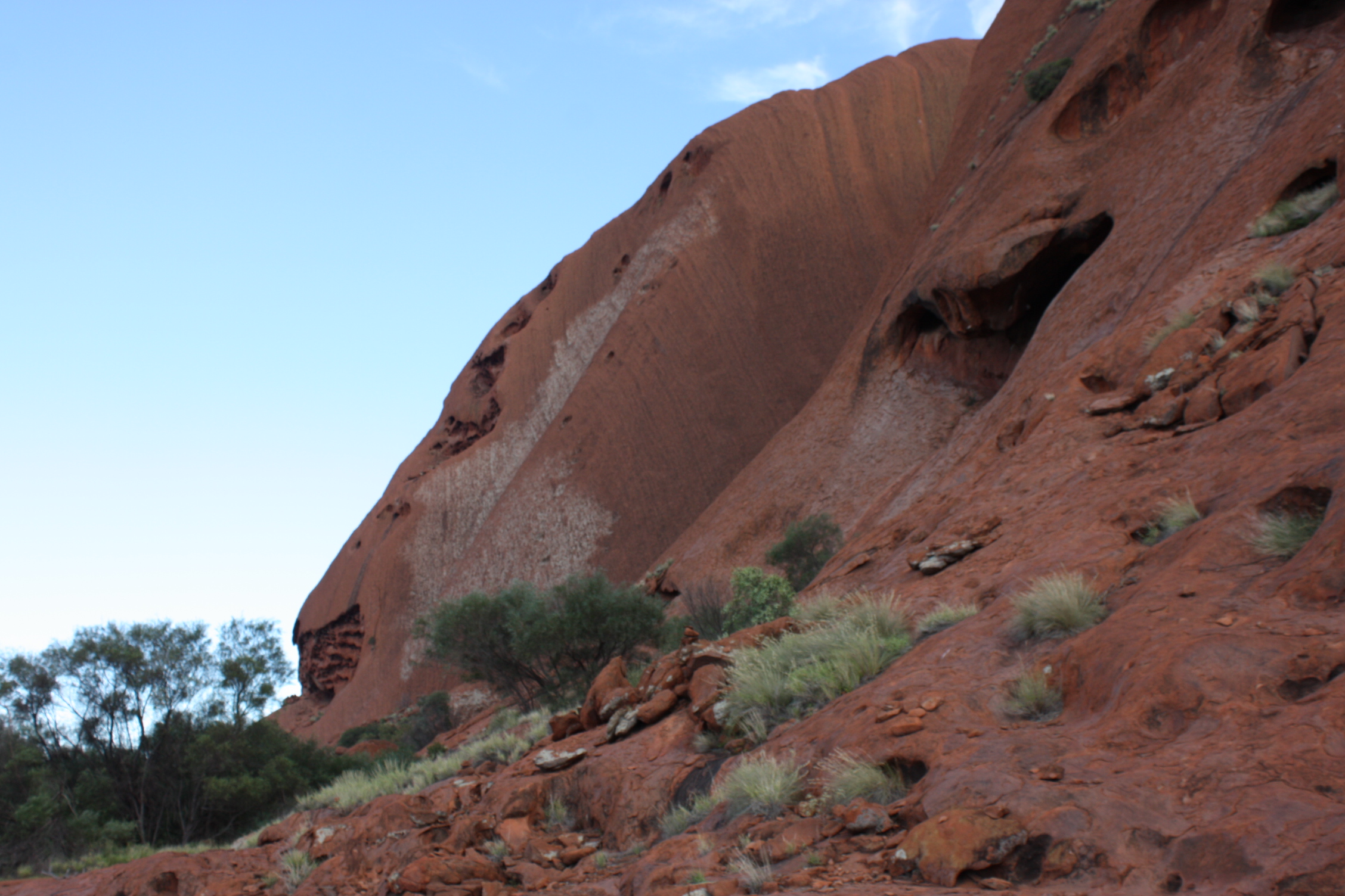
Uluru

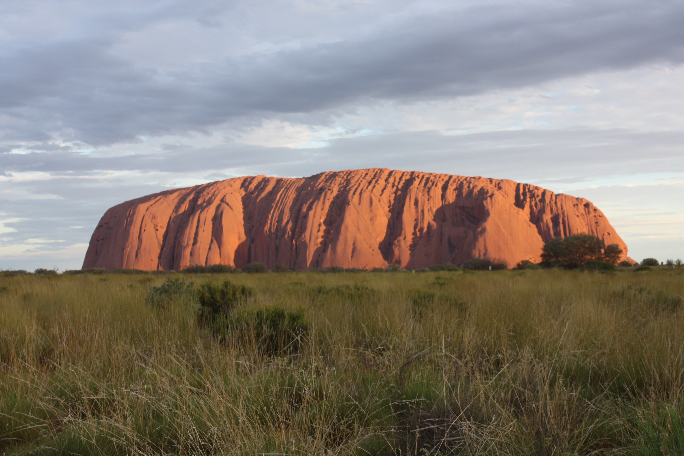


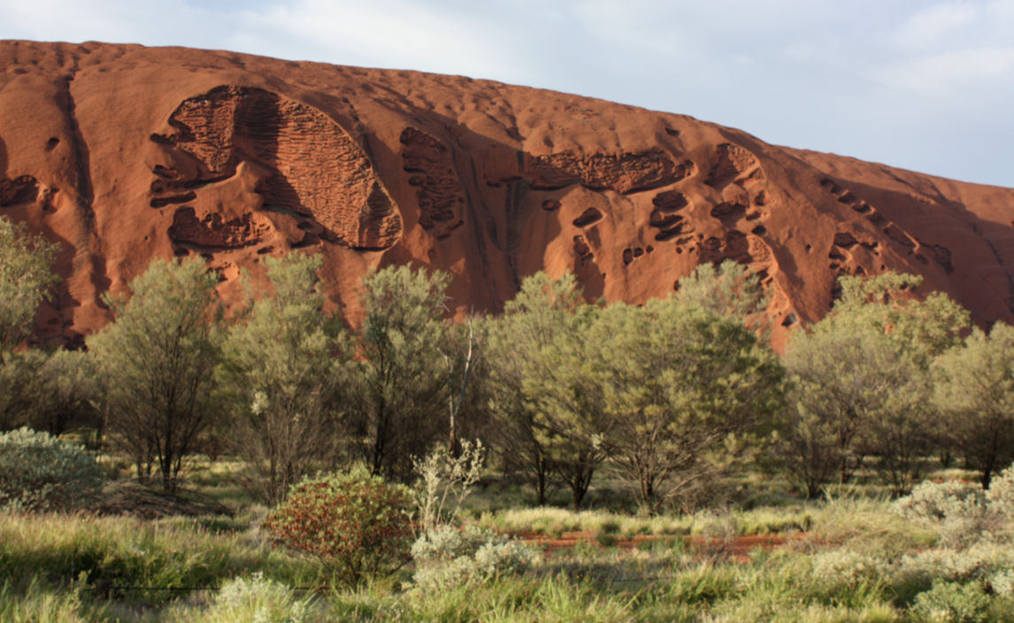
Uluru is 100 million years old—give or take a couple of mil. Being there verges on a spiritual experience. In fact, for the Anangu people it is a sacred and spiritual experience.
I adore this huge iconic rock, but it’s always been blisteringly hot when I’m there. In February 2000 it was 45°C, in December 2009 it was close to 40°C and last month, February 2013, it shot to 46°C on one of the days we were there.
But the high temperatures have never diminished my love for this magnificent monolith that seems to be marooned in the middle of Australia’s Red Centre. Scientists can’t be sure, but they think at least two-thirds of the rock is below ground, making it a desert iceberg. There is a scientific estimate that the bit of rock that is exposed weighs 285 billion tons.
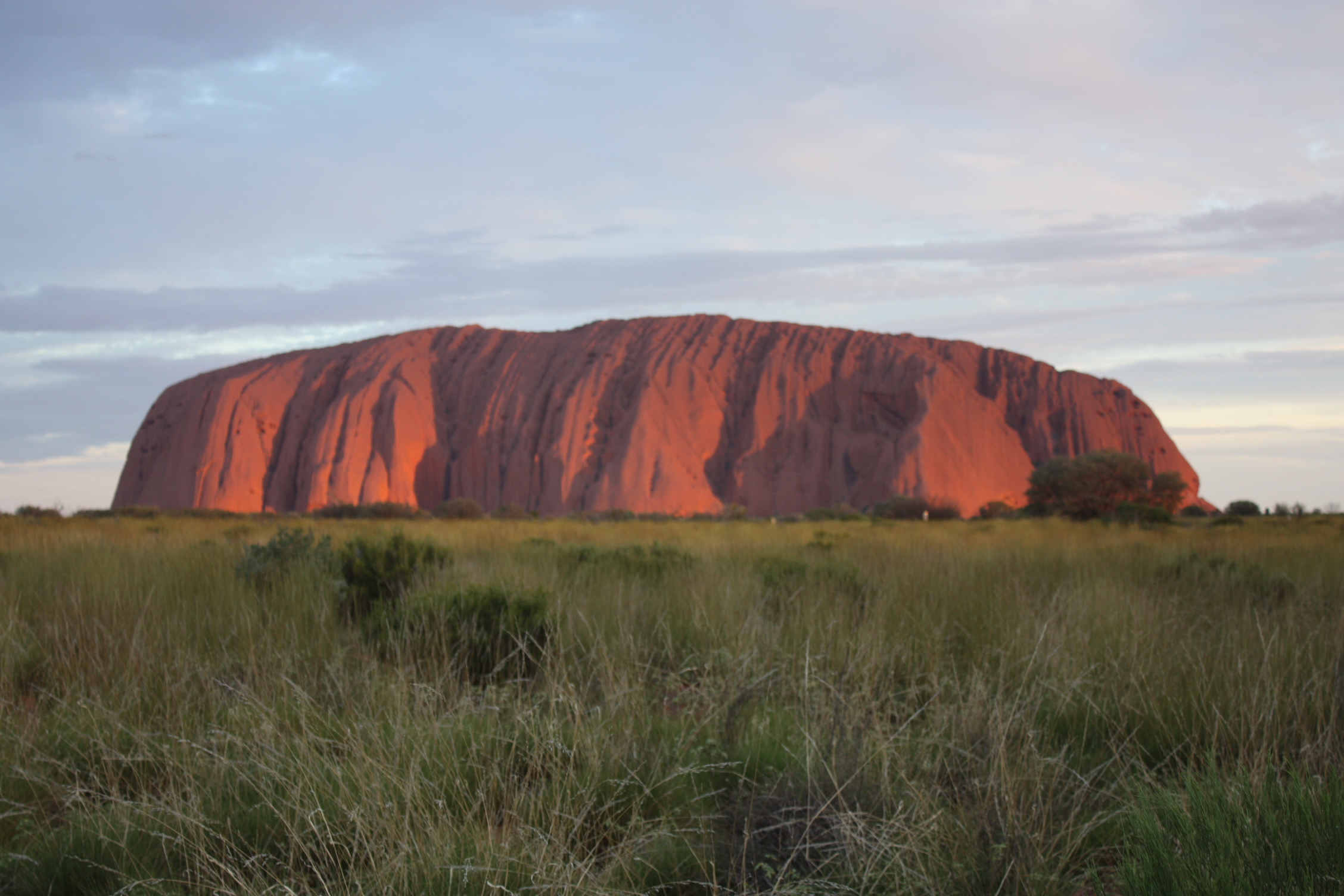
Most tourists are there to ‘experience’ the rock at sunrise and sunset. That’s when this ginormous block of sandstone flashes from pink to mauve to gold to red.
Some days are better than others. Of the three times I’ve been lucky enough to be at Uluru for sunrise and sunset, only two have been spectacular. That said, I’m still lucky and pleased that I can hop in a car anytime I want and drive there for another look (even if it is a 7000-kilometre return trip).
I’ve never climbed the rock, even though it’s allowed when weather permits or it is not being used for cultural activities.
I might have climbed in 2000, before the Anangu people made it so very clear that they didn’t want people to climb at all. But it was too hot and we didn’t have great walking shoes or enough water, so we walked around it instead.
It was an unplanned choice, but I’m really glad it worked out that way. I will never climb the rock and have signed a commitment to that effect. Uluru’s traditional owners say ‘You shouldn’t climb. It’s not the real thing about this place.’
In fact, they cite cultural, environmental and safety issues as main reason not to climb. In recent years, 36 people have died trying to climb the rock. This year, the climb was closed because of ‘summer’ but that really meant the extreme temperatures.
You’re not supposed to take pieces of rock away from the formation either, but plenty of people do. Aboriginal lore says that if you take some, you will be cursed and suffer misfortune.
No idea whether that’s true or not, but the cultural centre (where photos aren’t allowed) has a bulging binder of letters from people who are returning bits of rock they took on a previous visit. The details of misfortune in some letters really are scary.
Anyway, here are some views of sunset at Uluru. You can also see the posts on the Mala Walk, as well as my walk around the entire base of Uluru.
It’s official. I’ve entered the Biggest, Baddest Bucket List competition being run by mydestination.com. And I need your votes.
If I win, you send me your mailing address and I’ll send you a postcard from somewhere in the world.
Here’s some background on the competition.
Australia’s Red Centre
The prize is six months of all-expenses-paid, around-the-world travel to a value of 50,000. The travel needs to take place between June to December 2013. I know I can travel for long periods of time, and my passport is current and has plenty of empty pages.
In addition to answering some questions and providing some personal details, I had to submit:
• a video (max of three minutes) of a favourite travel destination
• a blog entry of 200 to 500 words
• three photos to illustrate the blog entry.
The first challenge was to pick a favourite travel destination. Good grief, I have too many.
But Sherry was visiting from the USA and we decided that a road trip to Australia’s Red Centre would be just the thing. No big deal, just 7000 kilometres round-trip in nine days and in 45°C weather.
So Sherry, Poor John and I loaded up the car and set out.
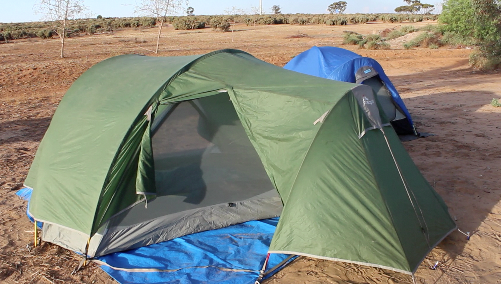
We traveled light and rough—a couple of changes of clothes, a couple of tents, three sleeping bags and roll mats, cooking and eating gear, some canned goods, an esky (ice chest), a couple of casks of wine and a useful book of free/cheap campgrounds.
The first night delivered a free lakeside campsite with a spectacular sunset thrown in. And no mozzies (Aussie for mosquitoes).
I’ll tell more about each aspect of the trip in subsequent postings, but this post is to urge you to vote for my entry.
An outback camping spot
There’s a big black and turquoise button in the top right of this entry. Please click it and follow the links. Then scroll down to the voting buttons. Click any of them for which you have an account (add a comment if you like) and share.
You can vote every day through the Facebook button (not sure about the others).
I’d love to win this. You know I blog and you know I have fun blogging. Five finalists are by popular vote and five are by judges’ choice. I’ll take either. Be sure to watch my video if you have time. That’s where the postcard offer comes in.
Thanks in advance for voting and for sharing my request far and wide.
Voting ends about the middle of April and it would be wonderful if you could add the voting button to your blog too. So vote often in anyway that you can. Thanks so much.
P.S. It was easy to chose a topic for the blog entry—the amazing mask dance in Dogon Country in Mali in West Africa.

A long view of Mount Conner. Often mistaken for being Uluru (Ayers Rock)
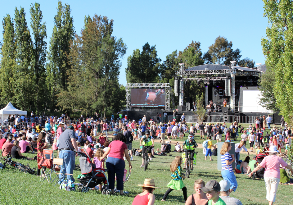
Canberra Balloon Spectacular
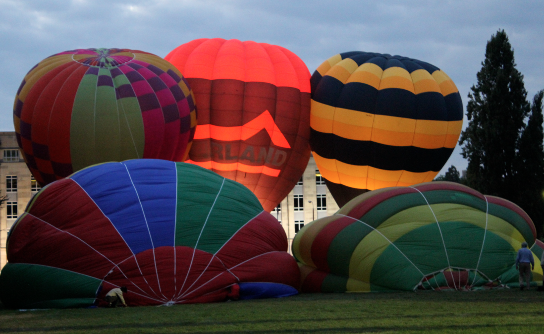
Canberra turned 100 this month and there were plenty of balloons to mark the occasion.
I’m not talking about your usual birthday party balloons—I’m talking about hot air balloons in all colours, shapes and sizes.
Canberra Balloon Spectacular
Known as the Canberra Balloon Spectacular, this popular event is in its 27th year. It really is eye-catching and rightly considered one of the top three hot air ballooning events in the world.
This year’s elaborate creations hailed from all over the world—Canada, Belgium, The Netherlands, Hong Kong, Taiwan—and all over Australia.
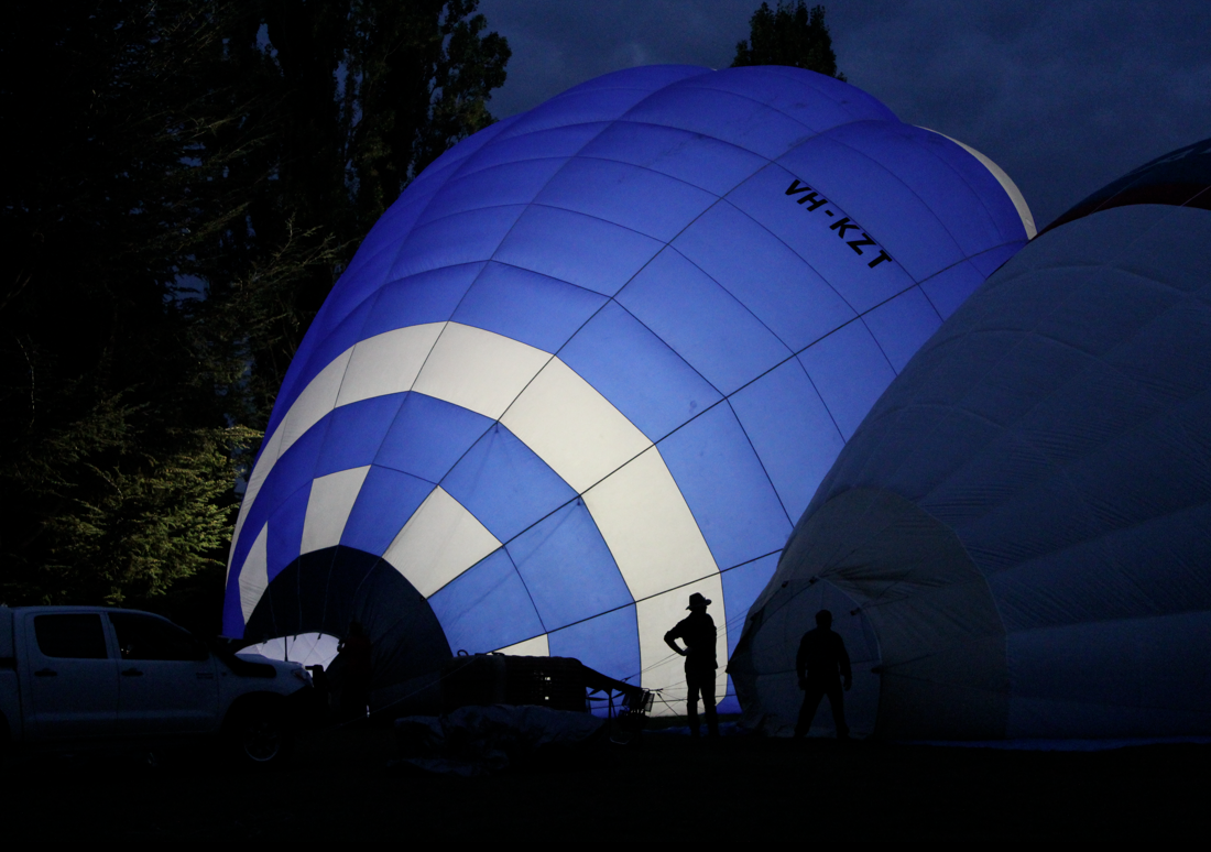
Every morning around 6, the pilots started laying out and inflating their balloons in front of Old Parliament House. Darth Vader oversaw the proceedings, so did Mr Bup (a pudgy turtle), a peacock and a black lion Simba. The Boy Scouts and many more popped in too.

The Boy Scout balloon swings and sways in the wind
Balloon launchs are weather dependant, and the day we visited was extremely windy and had its share of mishaps.
Some pilots had trouble controlling their crafts. The Boy Scout balloon swayed back and forth in the wind, and finally shot into the sky abruptly. The ground crew was annoyed by the speedy departure, but acknowledged that the wind was especially unpredictable.
Another balloon, which was launched just near the Treasury Building, couldn’t gain height quickly enough and hit the side of the building (sorry but I was too far away to get a pic). The balloon was shredded on one side and drifted to the ground. Fortunately no one was hurt.
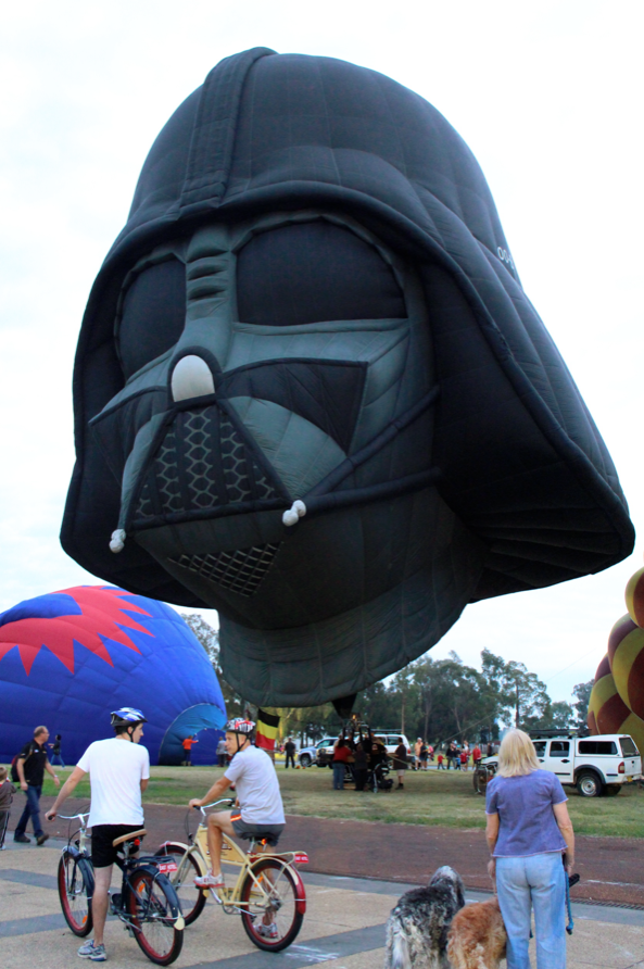
Darth Vader joins Canberra’s birthday party
After that, the pilot of the turtle balloon, which was also being inflated close to the Treasury Building, decided not launch.
I’m guessing that about 30 balloons took off the morning we were there, and it was amazing to see how quickly the wind whisked them away.
I heard that the next morning was so still that the balloons launched and then hovered (virtually stalled) right over the Old Parliament House lawns. What a difference.
About 15 years ago, I had a balloon ride over Canberra (a birthday present from Poor John). It was spring, the weather was perfect and we floated over the lake and all the main government buildings. It was so good that I got Poor John a balloon ride as a reciprocal birthday present the following year.
I’m thinking I need another chance for a hot air balloon ride. Anyone have recommendations for good places to fly high?
And before I go, don’t forget to vote for me in the Biggest, Baddest Bucketlist competition being run by mydestination.com. There’s a link to my entry here and in the top right corner of this page. Click and follow the links. You can vote daily until the middle of April.

Canberra in the pink on her 100th birthday
Canberra was officially named 100 years ago—12 March 2013—and we’re having a big-time celebration to mark the occasion.
Our event calendar has been huge—two pages of fine print. But the highlights have been fireworks, numerous concerts and ethnic performances, film festivals, hot air balloons, a 1920s gala ball, a football game, boat and horse races, exhibitions, food stalls and the world’s longest bubbly bar.
Boats out in force on Canberra’s 100th birthday
Yep that’s right, 800 metres of walkway on the edge of Lake Burley Griffin were set up to serve bubbly and tapas. Poor John and I resisted buying tickets to the event—heck he doesn’t even drink—but here are some of the details.
The event had multiple seatings, and was completely sold-out in advance. For $15, you could stay 45 minutes and have one glass of bubbly and tapas. An extra $10 got you a 90-minute stay and a second glass of fizz.

The bubbly bar was set up on that distant stretch of shore
The team of more than 100 servers expected to serve 800 people every 20 minutes, and go through more than 1600 bottles of grog (Aussie slang for alcohol).
Local winemakers created a series of celebratory wines for the event, including the Centenary Sparkling (we can’t call it champagne). Local produce was used in all the tapas options. To be sure, I would have loved to sample the roasted mushroom soup, deconstructed bruschetta, smoked capsicum (bell pepper) parfait, Clyde River oysters, smoked trout and slow-cooked pork belly.
One of many concerts by the lake
A little background on Canberra
In 1901, when the states of Australia came together as a federation, neither Sydney nor Melbourne wanted the other to become the capital. Ultimately it was agreed that a compromise location, in New South Wales, be chosen that was at least 100 miles (160 kilometres) from Sydney.
After a long process that involved numerous also-rans, Canberra, as a location, was identified in 1908. Then began the process to design and name this new capital.
An international design competition concluded in 1911, with Walter Burley Griffin, a Chicago architect, the winner. Griffin’s (he hated his middle name, but it gets used here all the time) entry relied heavily on the drawings done by his talented wife, Marion Mahony Griffin, the world’s first female architect graduate.

An Indian dance troupe at the celebrations
As a carefully planned and designed city (Burley Griffin even envisioned the lake), Canberra has a wonderful elegance and style, coupled with a bush setting.
People who don’t live here complain that it has no soul, no heart. Others say it’s just plain cold. Yes, it’s cold in June and July, when so many school kids make their only trip here as part of a school excursion.
But heart and soul? Canberra has got both in trumps. It’s a wonderful city and I feel lucky to live here. Plus, we live about a 10-minute walk from the lake.

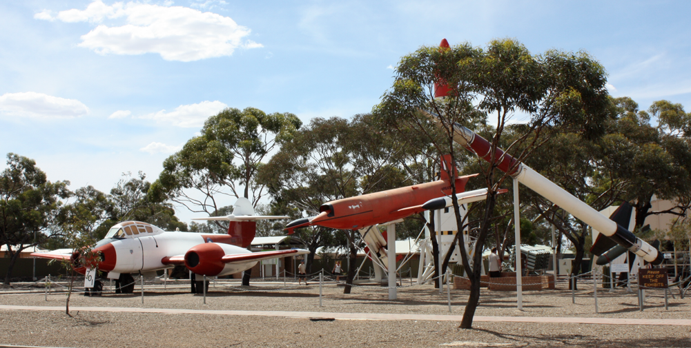
A rocket of Woomera
In the 1950s and 60s, Woomera was the world’s second busiest rocket range. Only Cape Canaveral was busier.
Today Woomera, located in South Australia’s outback, is a much smaller operation. It’s still an Australian Defence Force (ADF) base, commanded and administered by the Royal Australian Air Force, but rocket launches are a memory.
In fact, Woomera was at risk of closing in the late 1990s. About that time, a long-term study of ADF’s needs through to 2035 showed that Woomera had the only test and evaluation range in the western world that was suitable for testing ADF’s next generation of defence systems. A bonus was that Woomera’s climate meant it could be used year-round.
Around that same time, the Howard Government (don’t get me going on the Howard Government) set up immigration detention centres for asylum seekers. The village at Woomera was one such site. The detention centre was highly controversial and closed by 2003.
Residents now are defence workers or contractors, and the population fluctuates between 150 and 200.

More in the Woomera arsenal
We’ve been to Woomera twice since 2011, and had a long and interesting stroll around both times.
Everyone should check out Woomera’s National Aerospace and Missile Park, in the centre of town. It has missiles and rockets that were developed and tested there over the last 60 years, as well as some of the historic aircraft that were used in trials.
The Heritage Centre has a display about the legendary Len Beadell, the famous surveyor and road builder who laid out the original range across vast tracks of the Australian outback, stretching from Woomera to the far northwest coast of Western Australia.
A story about the rogues of early Woomera
Outback Australia brings out the mischief in folks. Decades ago and the night before a coming federal election, the workers of Woomera got well and truly pissed (Australian for drunk).
Drunkenly and collectively, they decided to vote for the Communist candidate. Oh boy, did that have the officials trying to figure out what was going on in Woomera.
A story about Len Beadell
Len really is a legend in outback Australia, where he created many of the roads. One day he came upon a truck stuck in mud up to its axles. The driver was nowhere to be seen. He’d no doubt gone to seek help.
Len used his tractor to pull the truck out and then used his grader to smooth over the mess. Later he wondered how the truck driver, on his return, managed to convince his rescuers that the truck really had been stuck.
Stand back and enjoy Woomera’s National Aerospace and Missile Park
